I apologize that the tone of these middle section posts is a little… bleak. The middle of the AT sucks too, so here’s hoping we rebound.
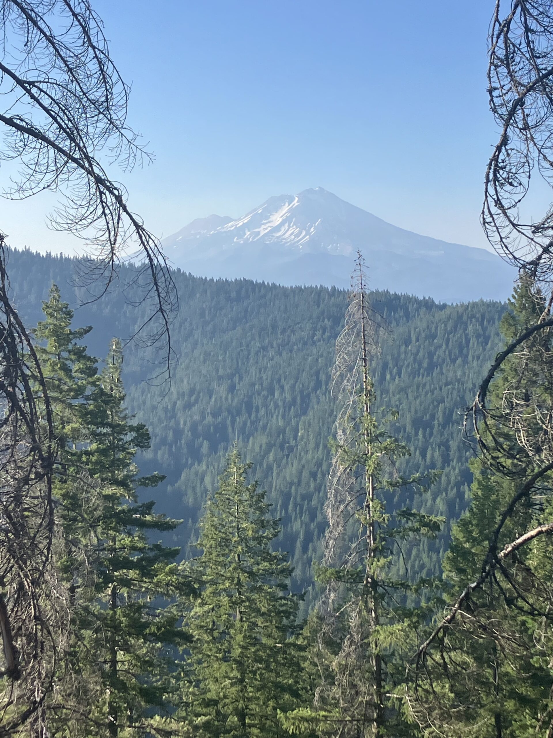
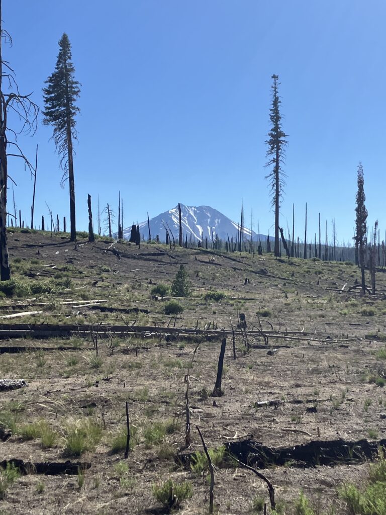
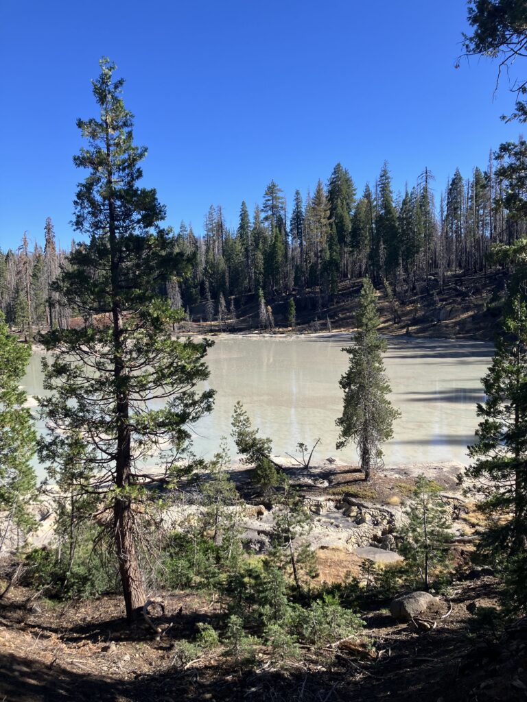
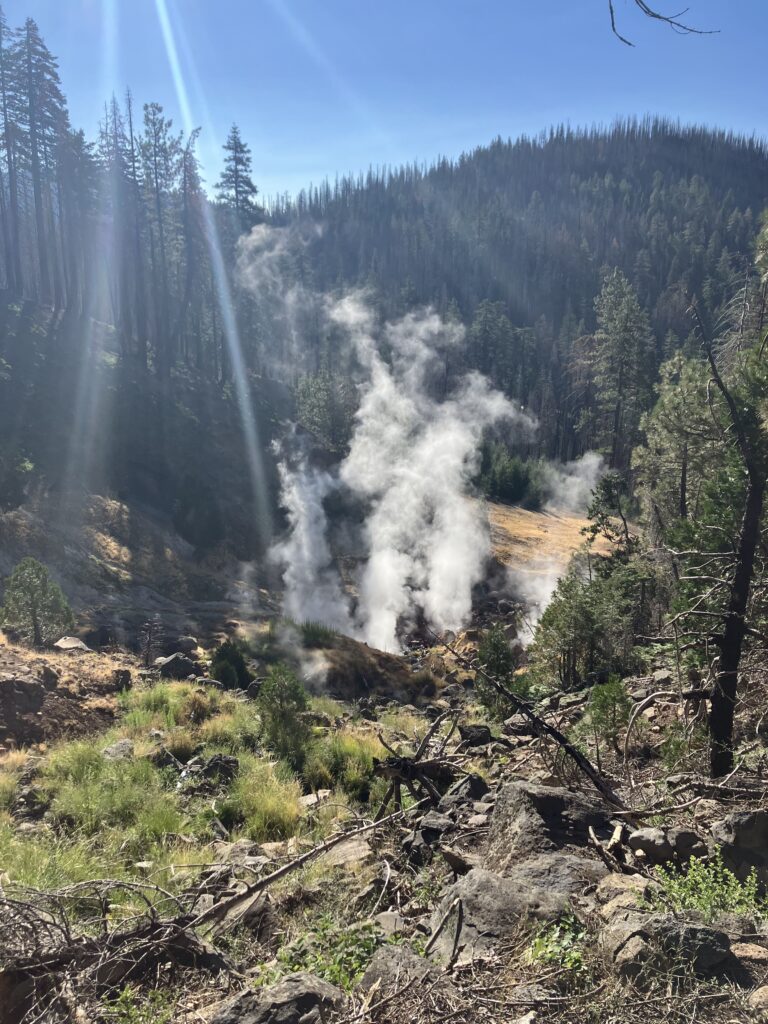
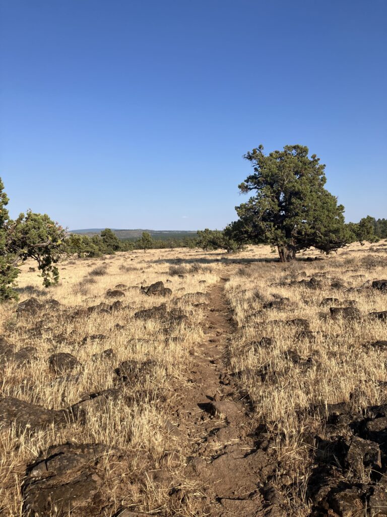
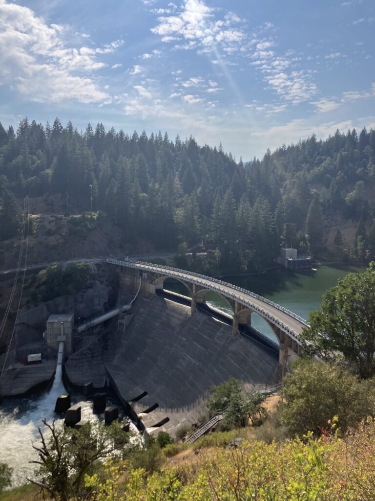
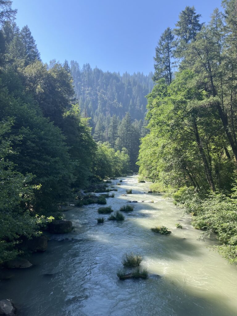
Just a few days after being there with Ben, I was back in Lassen Volcanic National Park. In the grand tradition of long trails in national parks, the section of Lassen that the PCT goes through is not especially interesting, though it may have been nicer before it burned. There were lots of good views of Lassen peak, so that was something. The trail didn’t go by many of the park’s geothermal features, but I made an effort to go see the few that it did.
At some point in the morning I had service and I took the opportunity to check the status of fires in the upcoming miles. And saw Oregon. I love Oregon – my dad is from there, I grew up going to the coast, I think it is a beautiful state. I have been looking forward to getting there on this hike. For a long time, I thought that I would move back to Oregon or Washington at some point, and while the biggest reason that I haven’t is that I’ve made a home for myself in Somerville, a contributing factor is the changing climate and increasing prevalence of wildfires. The record heat wave in mid-July triggered a series of thunderstorms, with over two thousand lightning strikes in 48 hours, basically setting the central region of the state on fire. Already there was a trail closure just north of Crater Lake, an area I’d especially been looking forward to. So far the section through the park wasn’t closed, but who knew if it would be by the time I got there. So, looking at the map of this place in flames, standing in another place recently destroyed, I broke a little. What was the point of continuing to hike when it was unclear how much of the trail ahead I’d even be able to do? Does it even count as finishing if I have to skip the entire state of Oregon? Was it even responsible to be out here? What would the Pacific Northwest look like after this year, or next year, or the year after? (For that matter, what would my home look like, or any of our homes – it’s easy to spiral on trail.) I’d said I wanted to do the PCT “before it was too late” but I realized it was already too late, and probably had been for some time. Don’t get me wrong, you can still hike the trail and still have a meaningful experience. But too late to count on the kind of end to end thru-hike we all imagine, too late to rely on comfortable temperatures, too late for the kind of idyllic hike that was always described to me by people who hiked the trail ten years or more ago. I still had service, so I called Ben to talk through what I was feeling, just so I didn’t keep spiraling in my own head. It helped, but I still spent much of the rest of the day processing this deep sadness.
I wouldn’t say it is processed now – obviously one day of hiking has not resolved all of my grief about climate change – but I’m starting to come to terms with what my hike will look like. I obviously knew that needing to go around fires was likely, but until it started to happen, I could delusionally hope that I’d get lucky. Here are some ideas that I have suggested or contemplated in the last few days:
Ben comes back and follows me up the trail and drives me around all the fires.
I go to the coast and hike up the Oregon Coast Trail to Tillamook, then cut back to Portland and resume the PCT. (Except everyone seems to actually hate the Oregon Coast Trail, as it consists of either beach walking or road walking and those are both bad.)
I go to the coast, acquire a bike, and bike to Tillamook. (And then leave the bike in Tillamook? Bike with my backpack on? I don’t know.)
I see if I can spend two weeks at my aunt and uncle’s house in Cannon Beach instead of hiking through Oregon.
I come home and Ben photoshops pictures to make it look like I finished the trail. (That one was Ben’s idea.)
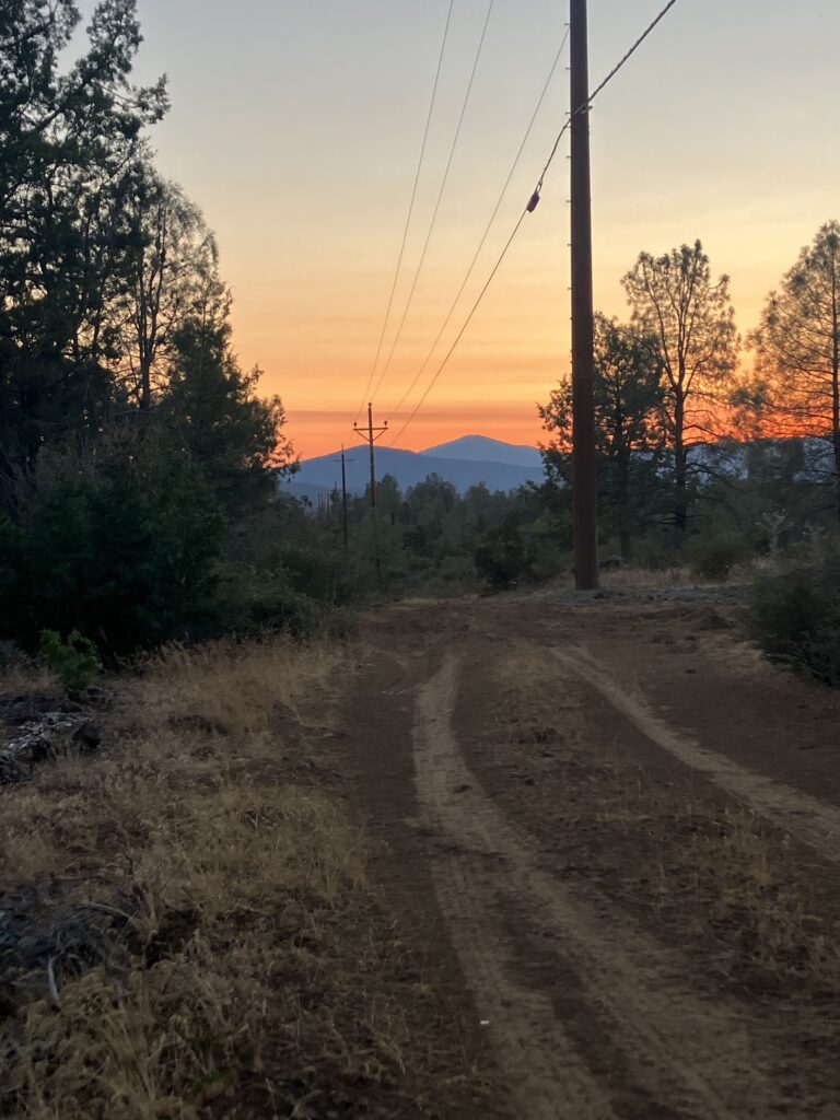
Obviously I hope that things don’t turn out to be so bad and I am able to hike through most of Oregon. But imagining the worst helps me to cope with whatever actually happens. Things didn’t exactly improve the next day. On the one hand, there was a diner and convenience store right off trail and I was able to get breakfast – incredible. On the other hand – everything thing else about the day. After breakfast, I was sitting outside the convenience store with a number of other hikers, preparing to face the rest of the day. I will note that in this section of the trail, with the fires, the heat, plus the general struggle of being right in the middle of the trail, everyone was losing it a little bit, not just me. As we all talked, it became clear that everyone knew or had seen multiple people on trail who were sick. Then a forest service ranger came over and told us to be careful – they’d had to airlift a hiker out of Lassen the night before for dehydration. I would bet money that it was a guy I’d seen near the end of the day who was obviously sick (he’d been with a seemingly healthy friend). As everyone put their information together, we were almost certainly in the middle of – or just ahead of – another norovirus outbreak. And we were about to head out on a twenty mile section of trail that was hot, exposed, and had virtually no water. (If you have seen or read Wild, this is where Cheryl Strayed ran out of water and suffered from heat exhaustion.) Temperatures were expected to reach triple digits for the next several days. The heat wave, relentless for weeks now, didn’t really seem like a wave at this point. Maybe one of the waves from the water planet in Interstellar. As I headed back on trail, I almost started laughing hysterically, things were just so hilariously nightmarish. It is times like these that I picture describing this to someone else and I can just imagine them asking “so why are you completely voluntarily doing this again” and it’s a really good question.
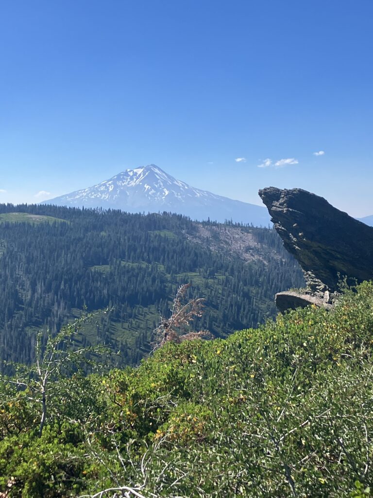
The silver lining to these conditions was that the trail is very flat in this section, so it was manageable to keep making good progress. The smoke from surrounding wildfires was becoming more and more evident, so while the guide claimed we’d be able to see Mount Shasta from the ridge that we would spend the day hiking around, I was skeptical. We could see it, it turned out, but just barely. In many ways the hike was very pretty, but July was perhaps not the time to do it. Early on the ridge, an older man was putting out water for hikers. I thanked him, and he commented on the smoke. I noted that we were all very aware of the fire conditions ahead. He nodded sadly and said, “I know you are. I wish you didn’t have to be.”
The next morning I came into Burney Mountain Guest Ranch, a hiker hostel just off the trail, and got to have breakfast again, another win. I was also able to shower and do laundry. It was a very charming place, with a pool and hammocks set up in the shade. The smart thing, perhaps, would have been to just call it and hang out there to wait out the heat (so, stay until September). Alas, I hiked on and the heat was really setting in now. Another silver lining of this section, is that for some reason there are really a lot of places to stop for food immediately on trail. It is not quite “a gas station or bar at every road crossing of the AT in New York” but it is decent. So for lunch I went to Burney Falls State Park, which features a general store, and rewarded myself with a milkshake. I stayed there through the afternoon, but even in the shade the heat was awful. When I forced myself to keep hiking at 4:30, it was still 102 degrees. In the miles after leaving the park, I didn’t feel amazing and even started to feel nauseous. Even though I was 99% sure it was the heat, a small, panicked part of my brain was obviously screaming NOROVIRUS. Sure enough, I made it to a creek, got in the water to cool down and instantly felt significantly better. I got my clothes damp and replaced my now very warm water with colder water and was able to make it to camp without any further nausea.
The next morning, I was packing up camp, mostly in the dark at 5am. I went to grab my headlamp and realized that I couldn’t find the small dry bag where I kept most of my electronics – charging cables, spare batteries, headlamp, and perhaps most importantly, my wallet. I tried to think – I remembered stuffing it into my backpack at the falls, but maybe I’d taken it out and left it at the creek a few miles back? Maybe I’d taken it out here at camp and couldn’t find it in the dark? I had my phone, fortunately, so I used the flashlight to scan briefly, but I didn’t see anything and didn’t want to waste my battery. I was really starting to panic now, and I had service, so I called Ben, even though I wasn’t sure what he would do from 3000 miles away. And as I called, a tiny part of me thought, maybe this is it, maybe this is when I quit. It turned out Ben could do a lot from 3000 miles away though. For one, he kept calm and talked me down. More critically, he reminded me that when he’d come to visit, he’d brought an AirTag and I’d put it in that bag. I used my phone to have the AirTag play a noise, and sure enough, there was the bag on the ground, looking exactly like a rock in the dark. It was still hot, and the days ahead still seemed vaguely insurmountable, but one crisis at least was averted.
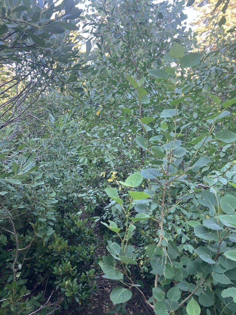
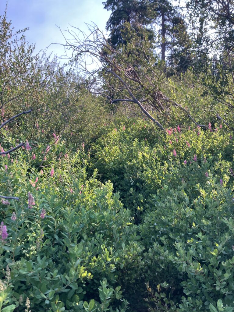
The trail was high enough on a ridge that day that the heat actually wasn’t too bad. You would think that this meant it was a good, easy day, but this is NorCal so you would be wrong. Instead, for the next 30 miles, the trail was periodically so overgrown that it felt like bushwhacking. At some point, I encountered a man hiking southbound, and I didn’t say anything but I must have looked exasperated, because he commented on the brush and said “It’s all part of the experience! You gotta love it!” Agree to disagree, random man, I do not “gotta love it.” (Older male solo hikers love to tell you how much you have to appreciate everything about the trail and the experience. They will also tell you exactly how you should be crossing a river/creek, if you happen to meet them there.) I continued fighting my way through shrubs, and I spent the day feeling like the gif of Homer Simpson disappearing into a hedge.
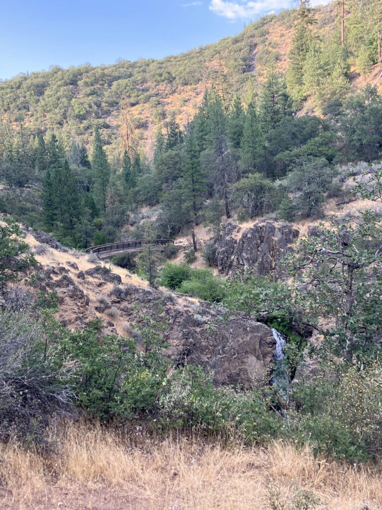
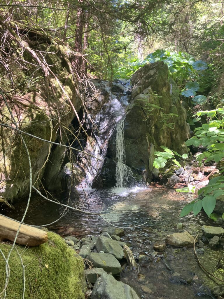
Alas, the next day the trail descended greatly in elevation again to cross yet another river, so while the trail quality improved, it was back to being oppressively hot. On the upside, after Burney, there did seem to be a break in the burned zones, so much of the trail was through forest and it was reasonably shaded. Every time the trail went through short, exposed sections, it was obvious that this was making a huge difference. I found a spot by a small waterfall to scramble down to for an afternoon break, and even though I was only twenty miles from town, I thought, maybe I will just stay here at this creek forever? Sadly, I didn’t really have enough food for that to be feasible. The next morning, I was able to take a bus to Mount Shasta, where I had new shoes waiting for me at the post office. It was a short day, so part of me felt like I should get back on trail and keep going. But after a pretty rough week and a half, it seemed like a good time to take a bit more of a break and enjoy some air conditioning. One last break before the final push in Northern California and (finally) leaving the state.
Laura Snyder
You forgot the best option…come home and hike the Long Trail with your mom!