Another fire skip here, around 85 miles.
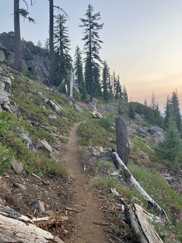
The Oregon section of the trail is not most people’s favorite – too boring, it’s said. But it is also known as the easiest section, with not much elevation change and really nice trail. Many people do the “Oregon Challenge” – attempting to cross the ~450 miles of trail in the state in two weeks, while some people see how many miles they can hike in 24 hours, generally aiming for somewhere between 40 and 50. I’m unlikely to do either of these challenges, but it was in that spirit that I left Ashland. Sort of true to expectation, the trail immediately after Ashland was neither particularly interesting nor particularly difficult. It wasn’t hard to do a 30 mile day, even getting a later start out of town. Near the end of the day, I was lured to visit the camp hosts of a nearby car campground by signs promising cold drinks (and potable water). I chatted with them for a bit and took a cold seltzer to go, hiking the last few miles of the evening enjoying the cool air and a cold drink.
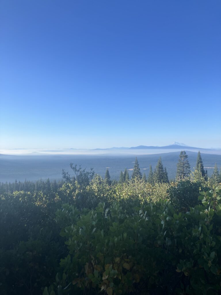
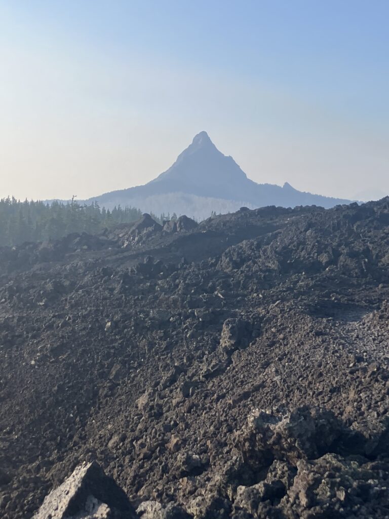
The next day it started to get warmer again, but luckily in Oregon there are trees. The trees are one of the main complaints about Oregon actually, the so-called “green tunnel.” (This term is also frequently derisively thrown around about the AT.) I, however, am a big fan of trees. Trees provide shade and make for a cooler forest. So I, personally, was having a nice, shady day. I also got my first taste of the volcanic side of the Oregon section, making my way through a large lava rock field. This was, admittedly, less shady, but it was short sections and it was neat, so I gave it a pass. This also ended up being my longest day on trail so far, at 38.7 miles. (My longest day on the AT was 36.5 miles, in New York. It was a chaotic day, preceded by an even more chaotic day that had involved me going to urgent care to get antibiotics. I showed up at the shelter to find my friend, who had thought I was ahead, and two older men out for the weekend. When I said I’d done nearly 37 miles, one of the men immediately offered me whiskey from a flask, which I accepted with a “sure, why not.”)
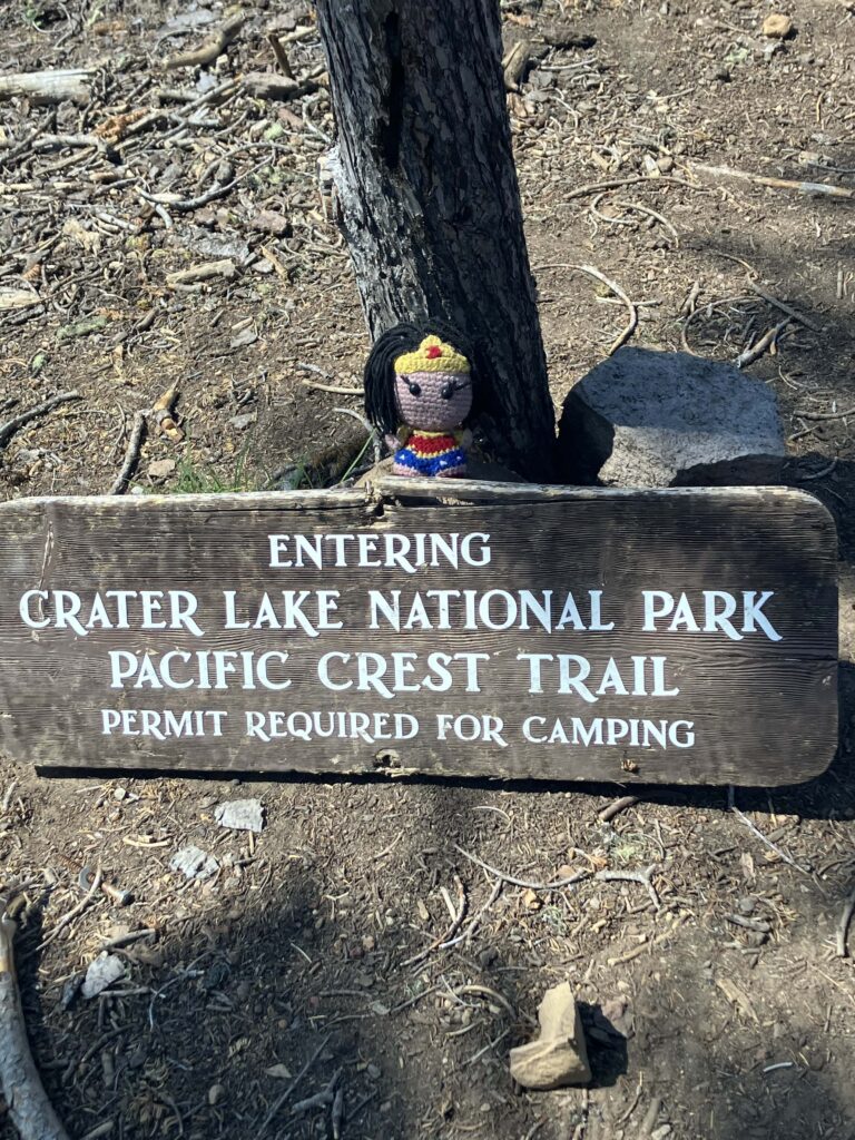
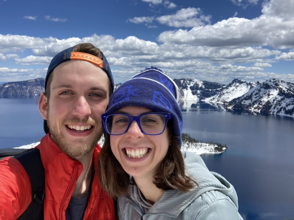
The next day was even warmer, the woods sparser and then giving way to a badly burned and exposed section of trail with little water. Oregon is, so far, much better at trail maintenance than California, with no overgrown bushes and most fallen trees cleared from the trail. But there are still a few gnarly sections of downed trees, mostly in burned areas, and this was one of them. So, not the easiest going. All of this was made manageable though by the fact that the section ended in Crater Lake National Park. Indeed, as if by magic, pretty much as soon as the trail crossed the park boundary, the burn ended and the trail was in excellent condition. Crater Lake is a section of the trail that everyone looks forward to, with good reason. Unfortunately, surrounding fires had made the whole area thick with smoke, not really ideal conditions for experiencing the lake. I’m lucky enough to have been there several times, and it is in fact a very special place for me, as it is where I proposed to Ben. (We agreed that I should be the one to propose, because I am better at planning and executing surprises.) So I was happy to be back, even if it wasn’t under the hoped for circumstances. The trail was closed in the park and for about 60 miles north. The camp host at the park campground was giving daily rides around the closure, so I signed up to go with him the next morning. You could still hike the rim trail around part of the lake, but given the thick smoke, I had decided not to, preferring to come back and hike this section at a better time. Indeed, the next morning when we drove along the rim headed north, there was so much smoke that you couldn’t see the lake at all. (Since I wasn’t able to get any pictures on this trip, here is a picture from when Ben and I got engaged, with the lake the way it was meant to be seen and experienced.)
I was dropped off on the other side of the closure at Shelter Cove, one of many lakeside resorts just off the trail in Oregon. I had already shown restraint and skipped two, focusing on actually eating my own food, but since I’d been deposited at this one, I took the opportunity to do laundry and grab some lunch. The smoke here was also quite bad, and it was another warm day. I tried to take it slow as I hiked the mile and a half back to the trail, and then accidentally hiked a mile and a half of closed trail, which I learned when I got to a road crossing and saw the trail taped off on the north side. (To be fair to me, that segment had not been closed last I checked and also, there was literally nothing wrong with it.) The afternoon was a slow, smoky climb, and I could feel myself getting a bit nauseous from both the smoke and the heat. One saving grace was that this section passed by plenty of lakes and ponds, so there were plenty of opportunities to cool down. Fortunately by evening both heat and smoke started to lessen and I ended up camping next to a really lovely lake.
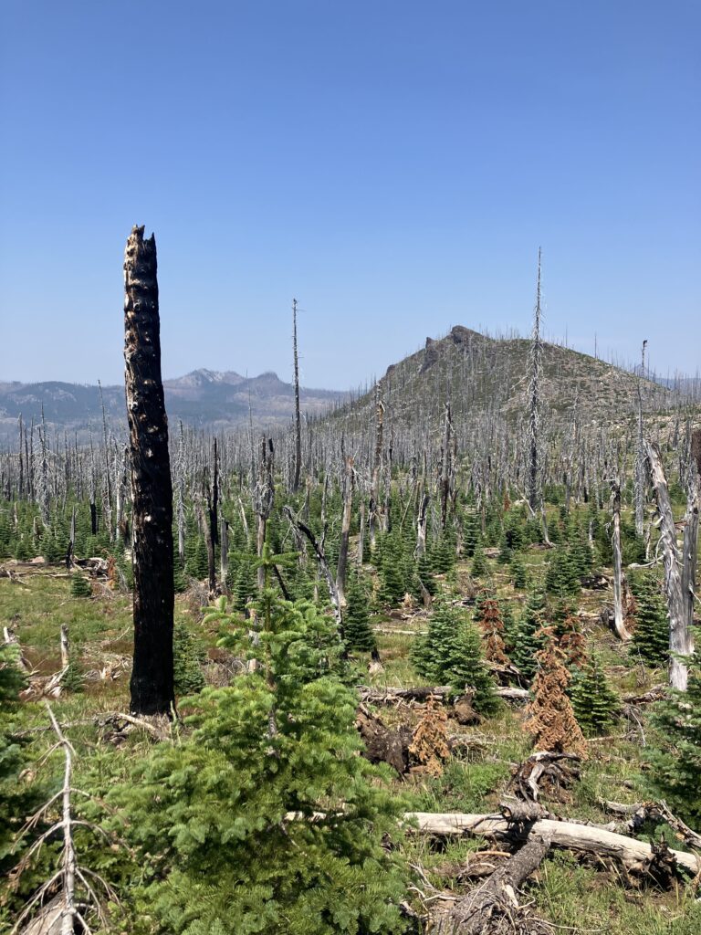
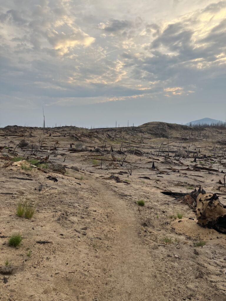
The next morning, almost immediately after leaving camp, I headed into a five mile section of absolutely destroyed burned forest. Most burn zones are like walking through the skeleton of the forest that was once there – the trees are dead, but the bones are there and you can see the shape of what once was. In this section, there was little left but ash and stumps. (Hikers like to think of the Lord of the Rings when they are traversing epic mountain ridges, but here was the part where Merry and Pippin lead Treebeard to see the destruction of the forest around Isengard and everything goes very quiet.)
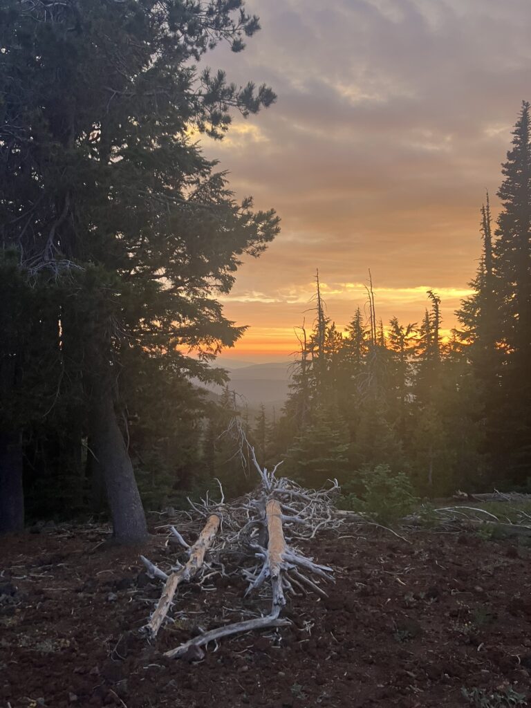
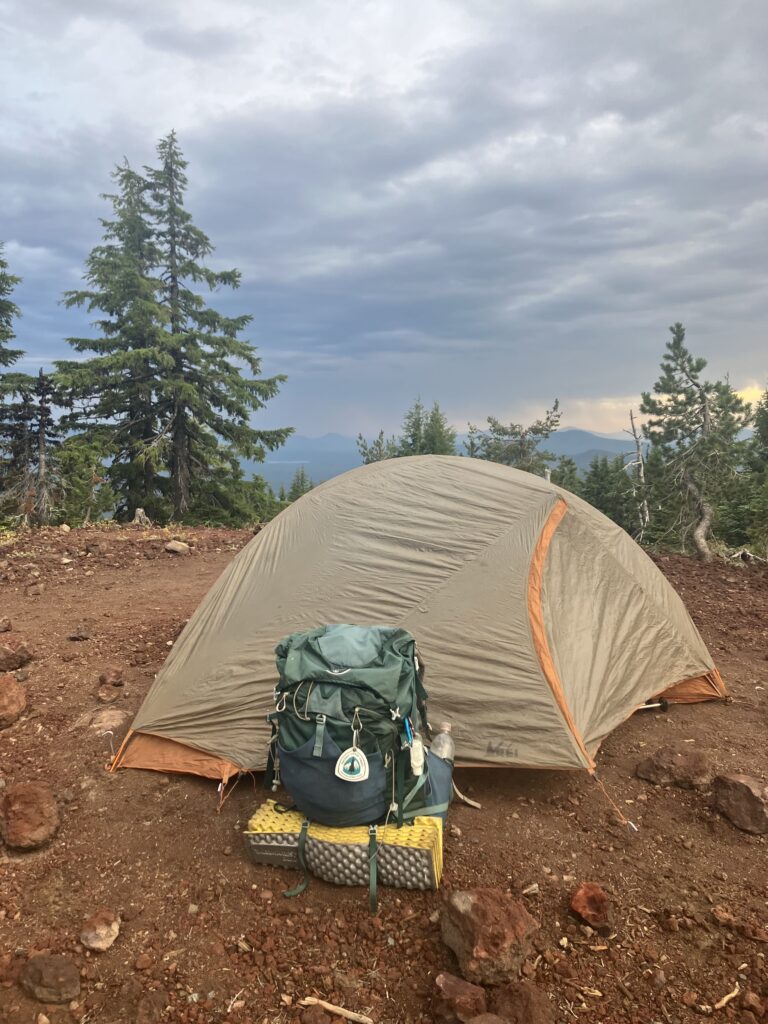
After that patch, though, it was back to a green woodlands with frequent ponds. Additionally, as if I had manifested it by spending most of the previous day thinking about how I missed rain, the day was overcast and sprinkled rain intermittently. It was the kind of Pacific Northwest summer rain that you can basically ignore, and it made me very happy. I lived outside of Seattle until I was five and I’m told it rained the full first year of my life, so I really wasn’t made to endure this much sun. In the evening, there was another lake resort, Elk Lake, about a mile off trail. While I did still technically need to eat my own food, I was having a good day and a hot meal by a lake seemed like a good addition. This choice really paid off for me. The resort had a great deck on the lake (in true PNW fashion, no one really cared that it was periodically raining), there was live music, and the table next to me talked to me a bit about the trail and then kindly paid for my food, which was incredibly good. (I feel like I also manifested my free dinner – at Crater Lake, I’d been talking to a hiker who said a couple had given him $40 to buy dinner, and I noted that while this had happened to me a few times on my bike trip after college, it hadn’t happened on this hike. Perhaps I no longer looked sufficiently sad and pathetic. Thankfully, I apparently still do.) I headed back to the trail with a waffle cone in hand, thinking life could hardly be better. It could though, just a little bit, as the rain cleared just in time for a beautiful sunset, and I had a great tent site basically on top of a mountain.
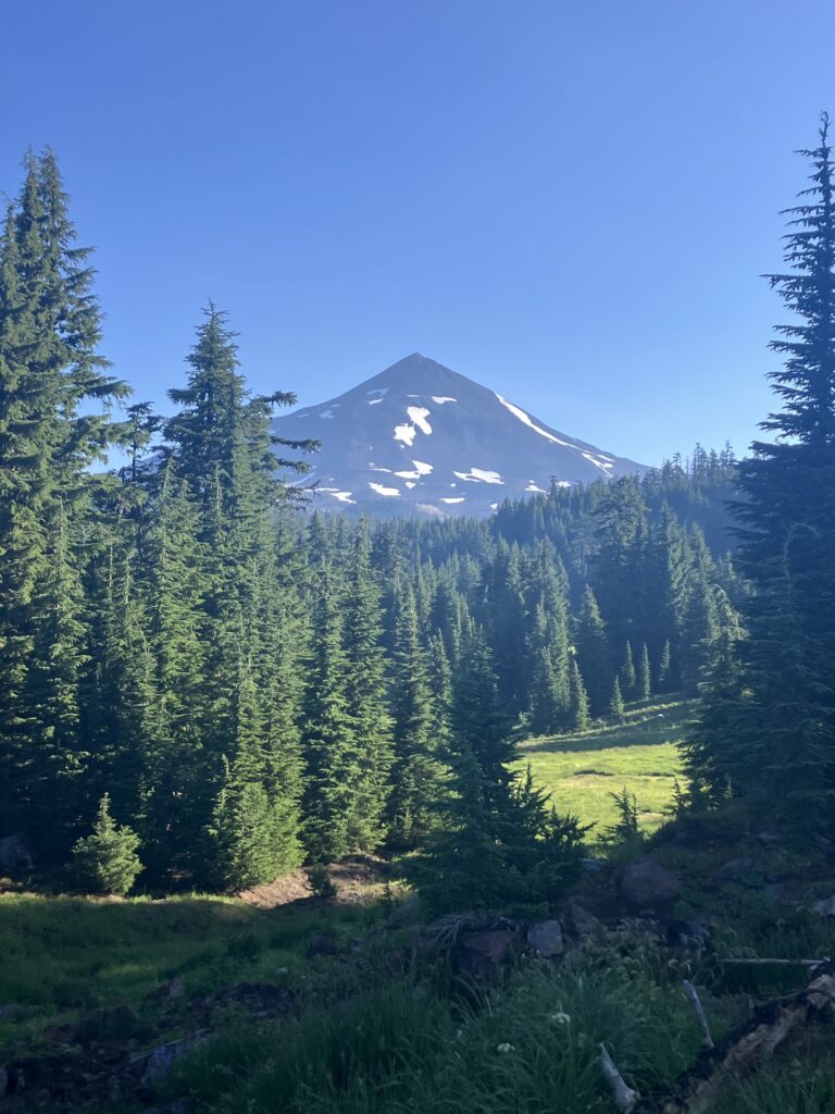
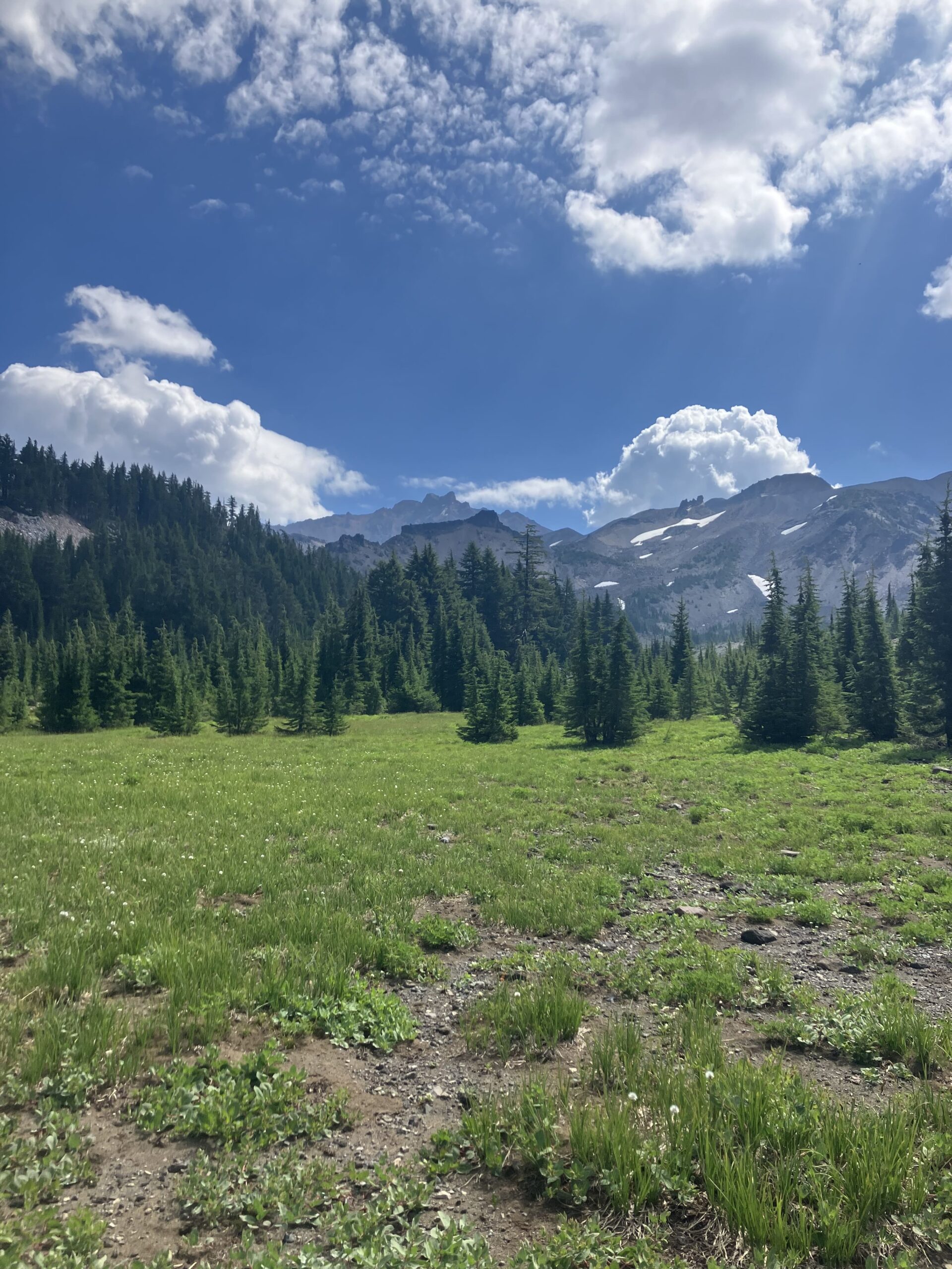
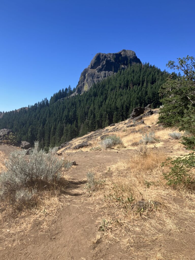
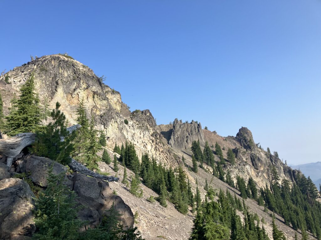
The next day was also quite nice, though sadly back to being sunny, and featured quite a lot of variety, a counterpoint to all the naysayers who said Oregon was “boring.” Unlike the continuous range of the Sierras, the volcanic mountains of the Cascades, such as Mount Shasta, Mount Hood, Mount Rainier, were generally singular, isolated peaks that loomed enormous over the landscape around them. Growing up in Washington, I’d always found this to be the most impressive form of mountain. (It was also honestly quite a while before I understood that not every mountain was an active volcano.) The trail in central and northern Oregon mostly goes from giant mountain to giant mountain, and now it was going around the Three Sisters (as you might guess, three large peaks clustered together – there’s also a Little Brother sub-peak). Several pleasant miles were spent going through meadows with incredible views of the mountains. The trail then went through the Obsidian Limited Entry area, a geologically odd couple of miles featuring a decent waterfall and copious amounts of the shiny black rock.
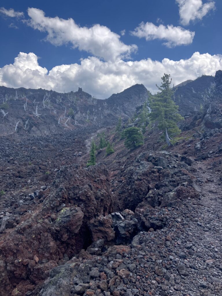
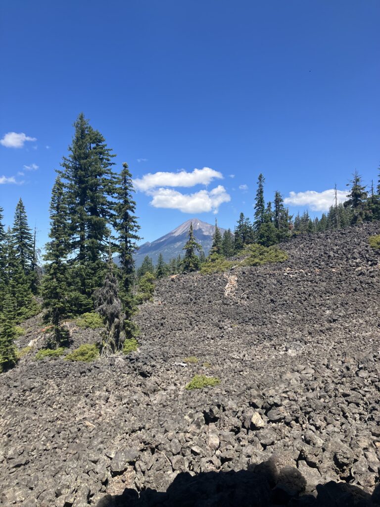
After the meadows and mountain views, the afternoon was very different, transitioning abruptly to a vast and seemingly endless field of lava rocks. (Here is where we ascend into Mordor.) Thankfully, it was not especially hot, since this was a long, dry, exposed section of trail. It was not especially easy going either, traipsing over the small (but not that small) loose rocks. It was, however, interesting and sort of bizarrely cool, like being on a different planet. I had known roughly when the field started, but didn’t actually know when it ended. Perhaps at the upcoming road crossing? But no, I got to the road, crossed, and saw lava rocks as far as the eye could see. I supposed I lived in the lava field now. After a few more rocky miles, I got to my planned campsite, which I saw now was some flat spots beneath some live trees that had somehow managed to grow in the middle of the rock field. In what I imagine is probably a pretty unique camping experience, I went to bed amongst my friends, the lava rocks.