It has taken a very long time to get around to writing this last entry, but better late than never.
After Stevens Pass, there were several long sections of the trail that were closed for fires, through Glacier Peak Wilderness and along Lake Chelan. In the original iteration of our plan, I was supposed to meet Ben in Stehekin along Lake Chelan in just a few days. But even though the fire near the town was improving, the lodge had finally and officially canceled our reservation. My new plan was to go around the fires, finish the last section of the trail, and get picked up by Ben near the border, officially done with my PCT journey, at least for 2024.
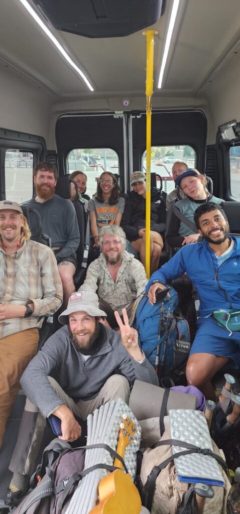
Plenty of people had managed to get rides around the northern fires, leaving from Stevens Pass or Leavenworth and getting a ride to Mazama, a small town on WA SR 20, where the last section of the trail picked up. However, this was also a closure that, for once, it was possible to get around entirely by public transit, so obviously that was what I would do. I would not say this was the most efficient way to get around Central Washington, but it worked and at this point I had plenty of time. To start, there was a free bus from Leavenworth to Wenatchee, which is apparently the apple capital of Washington. This would turn out to be the last real bus of the journey. I had a few hours to kill before the next bus, so I found a coffee shop near the station. I had gotten my ticket for the next bus ahead of time, which turned out to be a good thing, as it was not so much a bus as a van. This van to Pateros consisted of mostly hikers, with a handful of unfortunate other, normal people. Several hikers showed up without tickets, also not realizing that the bus was really a van – we managed to fit several on, but a few were left to hitch. In Pateros, we all waited at a bakery for the next bus (which was also actually a van), to Twisp, and the three hikers who had hitched from Wenatchee got there as well, and resumed the bus journey with the rest of us. In Twisp, we caught the last van of the journey (and also the last van that the service ran for the night), finally getting to Mazama. It had taken most of the day, but me, and about 12 other hikers, had successfully made it to the last town stop on the PCT.
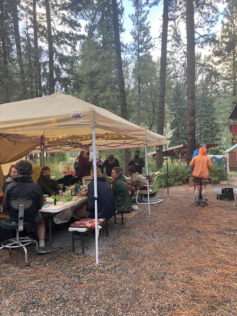
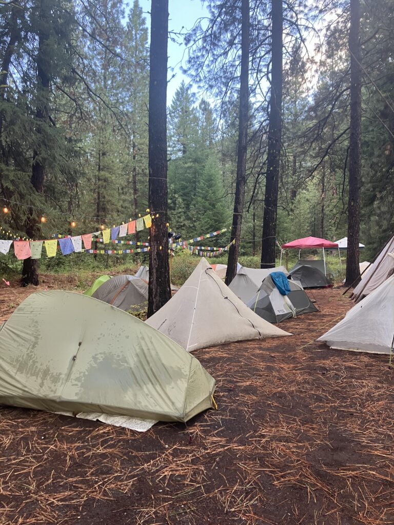
Mazama, as a town, consisted of: an expensive and fancy gear store, a semi-expensive brewery and restaurant, an expensive and fancy general store/bakery, and a hiker hostel that was primarily tent camping in the backyard. I could not really figure out why Mazama existed or why all three of its real establishments were so nice. It was starting to get dark and starting to rain as we all piled into the hostel, the Lion’s Den. It was supposed to rain significantly overnight and until the next afternoon, leaving most people unsure when they’d get back on trail. It wasn’t exactly balmy and pleasant where we were, at around 2000ft, but the trail picked back up around 6000ft and the rain we were getting was supposedly snow up there. I had thought that I might head back up to the trail in the afternoon, once it stopped raining, but it turned out that the weather didn’t really clear until late afternoon, and the ranger who manned the campground near the trail crossing had advised that no one come up until the next day. So, I ended up taking another zero, waiting for the storm to pass. There were lots of us there, so it wasn’t lonely. In some ways, I finally felt like I was getting some of the camaraderie and culture that I’d found on the AT but had been missing out here, right at the very end. I spent several hours with a few other hikers at the fancy bakery, drinking coffee and sharing experiences with other trails. One of the other hikers lived in New Hampshire, working at the Notch, a hostel I’d stayed at on the AT and several times since. At the hostel, we played scrabble and some people cooked. In the evening, the rain finally clearing, a large group of us sat around a fire pit and discussed how much we’d loved (and hated a bit, but mostly loved) the AT.
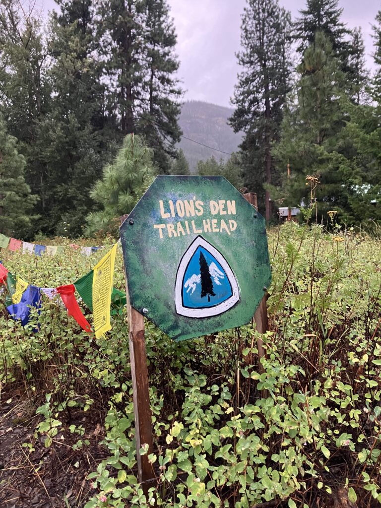
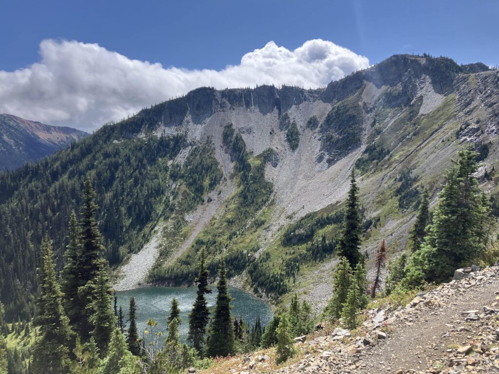
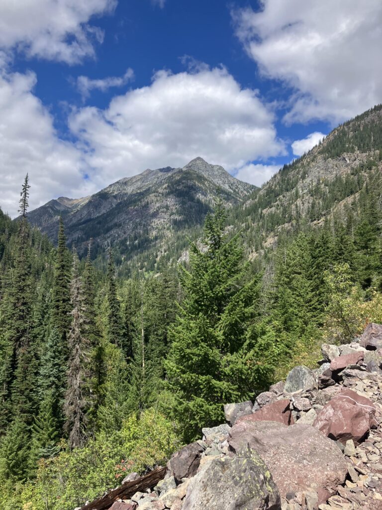
The next morning, as if by magic, the sun was out. Most hikers were getting a ride from the hostel to the trail crossing – the trail was about 8 miles down a paved road, and then 10 miles and 4000ft up a dirt road to Harts Pass, the last road crossing of the PCT. I still had time to kill before Ben would arrive – he was driving out from Boston to meet me, and there were still a few days before he would get here. So I opted to walk up the road and then up an alternate trail to rejoin the PCT. I had one last coffee and cinnamon roll at the bakery and then headed back, for the last time, to the trail. It was a nice day, sunny and warm, though not too hot, and I slowly climbed almost 5000ft back up to the trail. I rejoined the PCT and camped near some of my first views of the North Cascades.
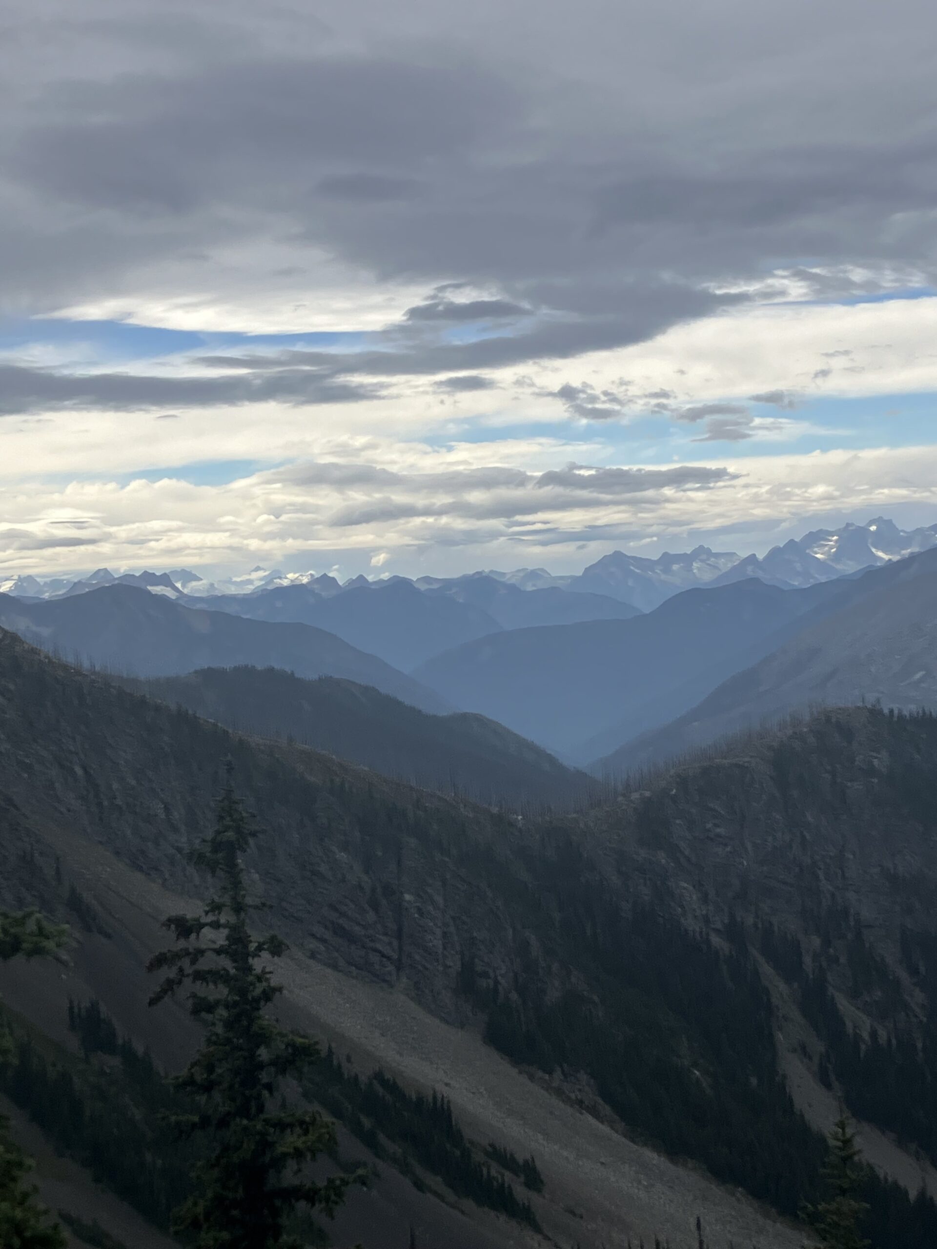
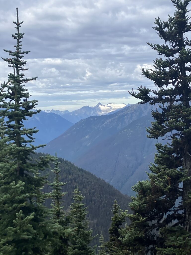
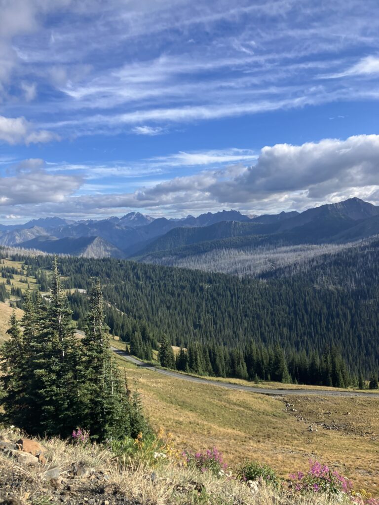
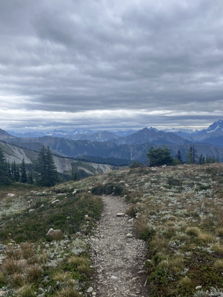
The next day was mostly sunny again, though a bit windy and chilly up at the higher elevation. My plan was to hike to a camp spot about 3.5 miles from the Canadian border. From the border, northbound hikers have two options: you can keep hiking into Canada to the next road crossing, about 8 miles, or you can turn around and hike 30 miles back to Harts Pass. Because of timing and where Ben was coming from, we determined that it made the most sense for me to hike back to Harts Pass, so everything I was seeing now, I would see again from the other direction. Luckily, this last section was quite pretty, and not terribly difficult. Late in the afternoon, I climbed to the pass of the trail, knowing that it was all downhill from there to the border, but also that every step I went down from here, I would just have to come back up tomorrow. I got to camp reasonably early, but the forecast called for a chance of more rain and snow in the evening and overnight, so I set up my tent and hunkered down.
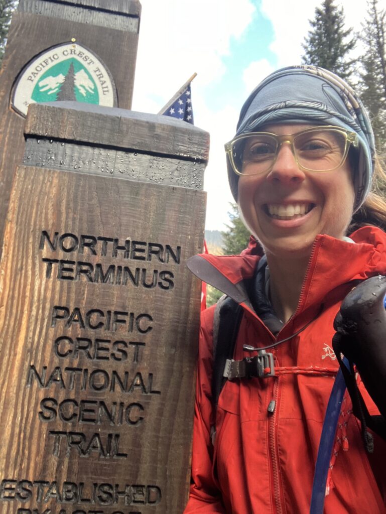
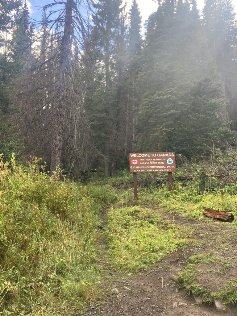
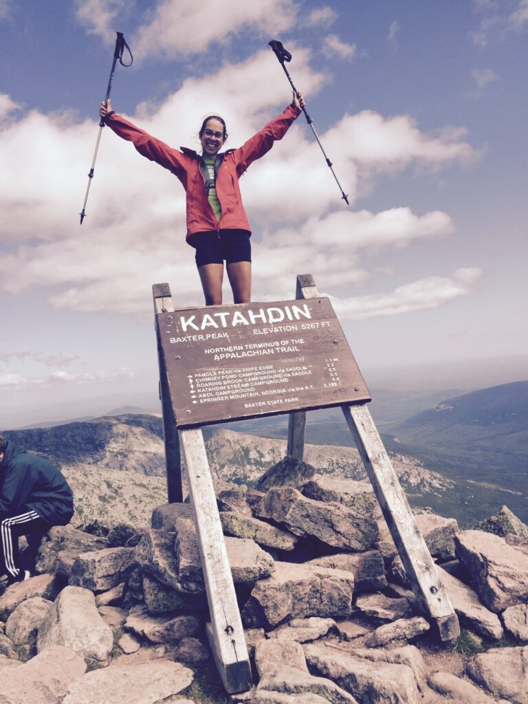
In addition to killing time while Ben drove to meet me, I had another, deeply idiotic reason for planning my daily mileage the way that I did. I had been hiking 30+ mile days all summer, I could have finished much more quickly than I actually did and just gone back to hang out at the Lion’s Den and wait for Ben in Mazama. But, in 2017, I had climbed Mount Katahdin and reached the northern terminus of the Appalachian Trail on August 27th. So, on August 27, 2024, I got up and walked to the Canadian border, the northern terminus of the Pacific Crest Trail. I brought my bag and food, but I left my tent set up, in the vain hope that it would dry out a bit more before I had to pack it up. Then I set off on the last few downhill miles of the PCT. I knew, even before I hiked the AT, that finishing the AT on Katahdin would likely be the best moment of my hiking life, and that if I did the other two long trails, the PCT and the CDT, their finishes – just a sign at the border – would feel anticlimactic in comparison. And that was 100% correct. Sort of hilariously, everyone tells you how amazing the views on the PCT are, especially compared to the AT with its endless trees. And then the last few miles of the PCT, it turns out, are a pretty boring trek through the woods with no views. I was in an especially annoyed mood about it, because the trail was once again quite overgrown and everything was wet, which meant that after a few minutes of pushing my way through rain soaked bushes, I too was completely soaked and also cold. And then, suddenly, I was there – the sign in the woods that signaled the end, mostly, of my journey. I hadn’t managed to hike every mile, but I had done the best I could, and I had still made it from Mexico to Canada, in some way or another.
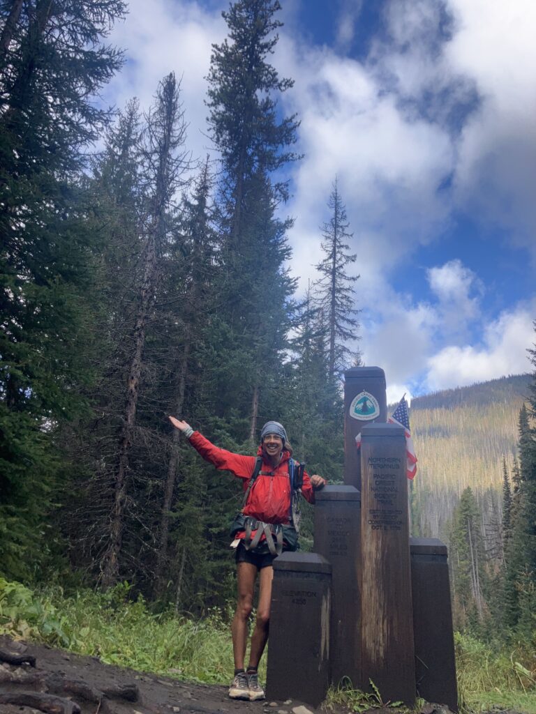
Unlike on Katahdin, where it had been a beautiful day and there were tons of day hikers on the mountain who cheered for you when you finished, I finished the PCT alone. I took pictures, and then it was time to head back out. Not only did my tent not dry off in the time it took me to walk to the border and back, but it actually started hailing on me as I climbed back up. By the time I got back to my tent, I was thoroughly wet and cold and very grateful that I”d left it up. I got back in, climbed into my sleeping back and waited to warm up and for it to stop hailing. Eventually there was a break and the sun came out, sort of, and I took the opportunity to jump out and pack up as quickly as possible.
I had thought I would be annoyed at having to climb back up all the hills I’d come down the day before, but in fact I was grateful for the climbs, which kept me a bit warmer. I basically didn’t stop hiking for the next 6 hours and I didn’t really take any pictures, because I was busy trying not to die. (This is obviously an exaggeration, I was always perfectly safe.) At first the break in the rain/hail held, though it was very windy and quite cold. Then, several hikers who were going the other direction passed me, and they seemed to be dressed for mountaineering and were covered in snow. They looked at me, in my shorts, like I was insane. (I realize that I have mentioned being cold several times and yet was still wearing shorts, but I had a reason! It was also very wet, and my pants were not water resistant. I figured wearing wet pants would not actually make me any warmer, and my legs dry faster than the fabric.) Sure enough, I went around a corner and was essentially engulfed in a snow storm. Luckily, this didn’t last too long, I made it through the next pass and the snow calmed a bit and then cleared. The rest of the afternoon went on like this, with the weather switching dramatically every 15 minutes or so, and I got hailed on or snowed on several more times. I realize that I spent most of the summer complaining about how hot it was or how I missed the rain, but this was not really what I wanted instead. What about a nice 65 degree slightly overcast day? I finally set up camp – it wasn’t very late, but it was too cold to stop moving and not be in my tent.
That night, the temperature got into the 20s and it snowed some more, but I stayed warm as long as I stayed in my sleeping bag. When I got up the next morning, it was very chilly, but I had two things going for me: the wind had calmed down and it was dry and sunny, and this would be my last morning waking up on trail. In just a few hours, Ben would meet me at Harts Pass, and we would drive back home together.
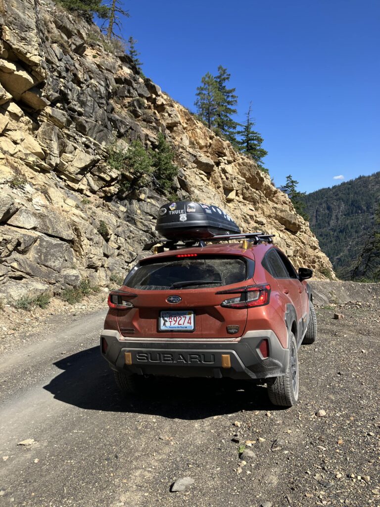
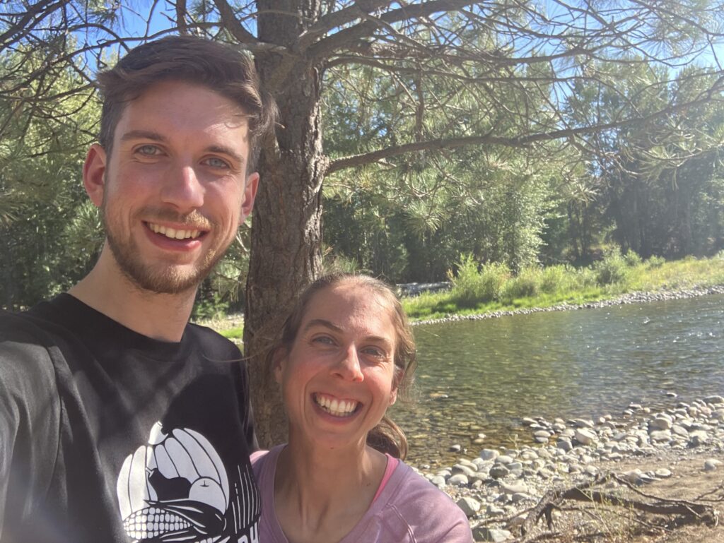
I hiked my last few miles and suddenly I was out – back at the campground at Harts Pass. I was a bit early for Ben, but a woman was there doing trail magic, and I sat with her until Ben got there. While waiting, I walked down the road a bit to try to get a better cell signal, and I saw an orange Subaru driving up the (pretty treacherous) dirt road. Sure enough, it was Ben. Six or so weeks since he’d left in Sierra City, and three months after he dropped me off at the Mexican border, we were finally back together. While I was sad that I’d had to skip so much trail (I hoped to come back to at least some of it), and while the end of my journey had been a bit anticlimactic, I was still happy to have experienced it. But I was just as happy to be heading home, back to my friends and family, my own mountains in New England.