Big skip here – Washington is pretty on fire, it turns out.
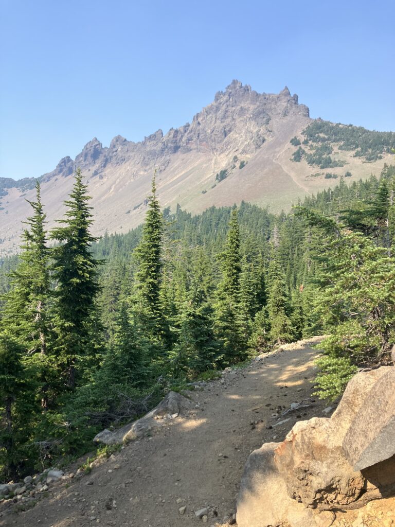
After camping amongst the lava rocks, it turned out that that was basically the end of the lava field. It transitioned seamlessly into what seemed like a fairly recent burned area. The trail circled around Mount Washington, which was taller and pointier than our Mount Washington in NH, but certainly less significant within its own mountain range, being less impressive than nearby Mount Jefferson and Mount Adams (and obviously Mount Hood). A few miles into the day, I stopped by Big Lake Youth Camp (on the shores of the imaginatively named Big Lake), a camp area that had a building set aside for hikers with showers, laundry, and a kitchenette. I took the opportunity to shower, charge things, and eat breakfast. It was a nice place, but it was a little disorienting to call Ben with the sounds of children yelling in organized activities in the background. After leaving the camp, I made it approximately three quarters of a mile before stopping again where a group was doing trail magic out of their RV – pancakes, fruit, cookies, drinks, the whole deal. I sat and talked with them for a while, and with the other hikers there, who were hiking southbound. Two of the other hikers had section hiked the trail before, in 2011 and 2014, and it was interesting to hear from them how much the trail had already changed – landscape, climate, culture, etc. Reluctantly I moved on – I did need to do some hiking for the day and I still needed to go into Sisters to resupply.
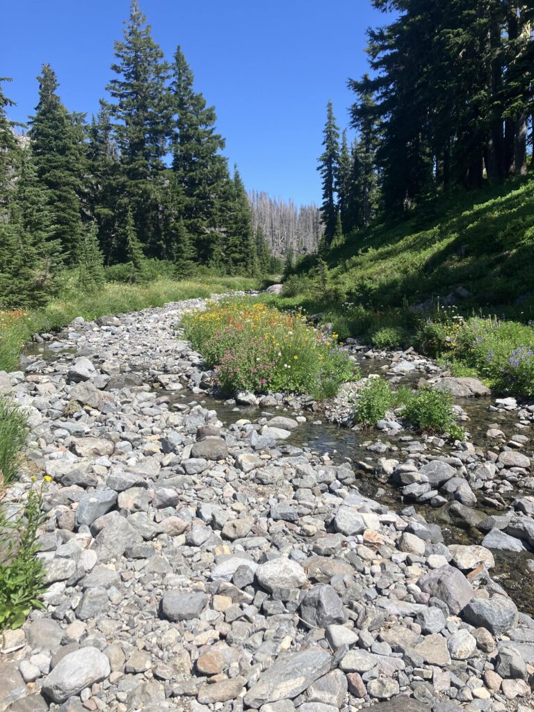
In the four miles before the road, I did hit another big milestone – mile 2000 on the trail. With the two skipped sections, it wasn’t quite 2000 miles hiked, but it was still a good moment. Most people at this point went into Bend, a cool town, but Bend was pretty far off trail and I was just going in and out for groceries, so I went to the closer town of Sisters. Sisters seemed to be extremely Western themed, with even the Dollar General, made to look like it was part of a town in the old west. Sadly, I didn’t spend much time there, getting groceries and lunch and heading back out. Back on trail around 3pm, I was finally ready to start hiking again. Some days are just not productive hiking days. I had been warned that there were pretty extensive burn zones for the next 50 or so miles, and that was certainly true as I started climbing into the Mount Jefferson Wilderness area. Luckily, there were some breaks, and I was able to camp by a very pretty lake in an unburned area.
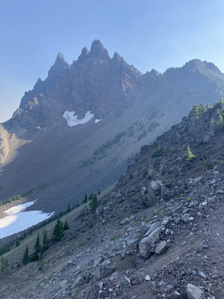
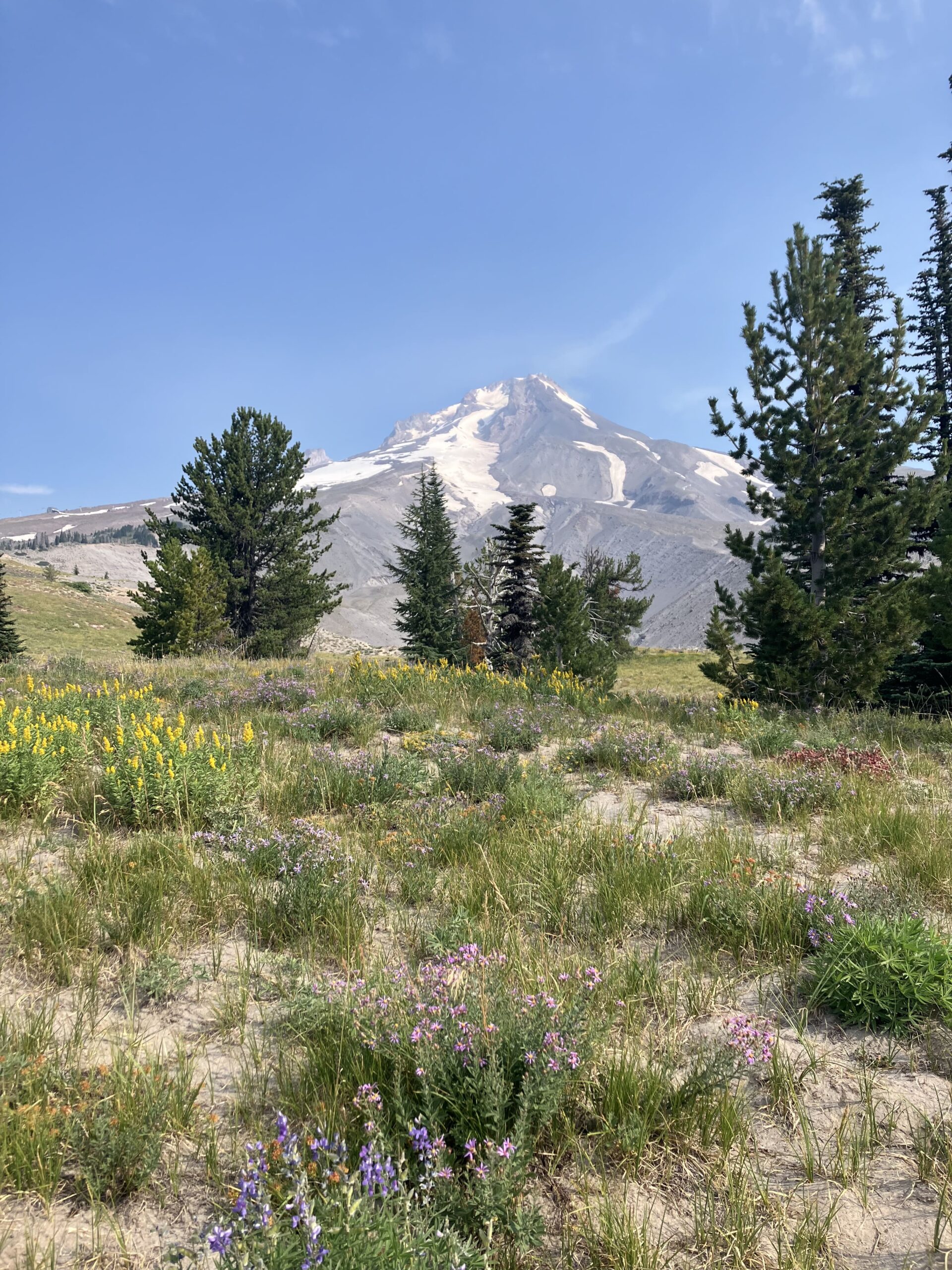
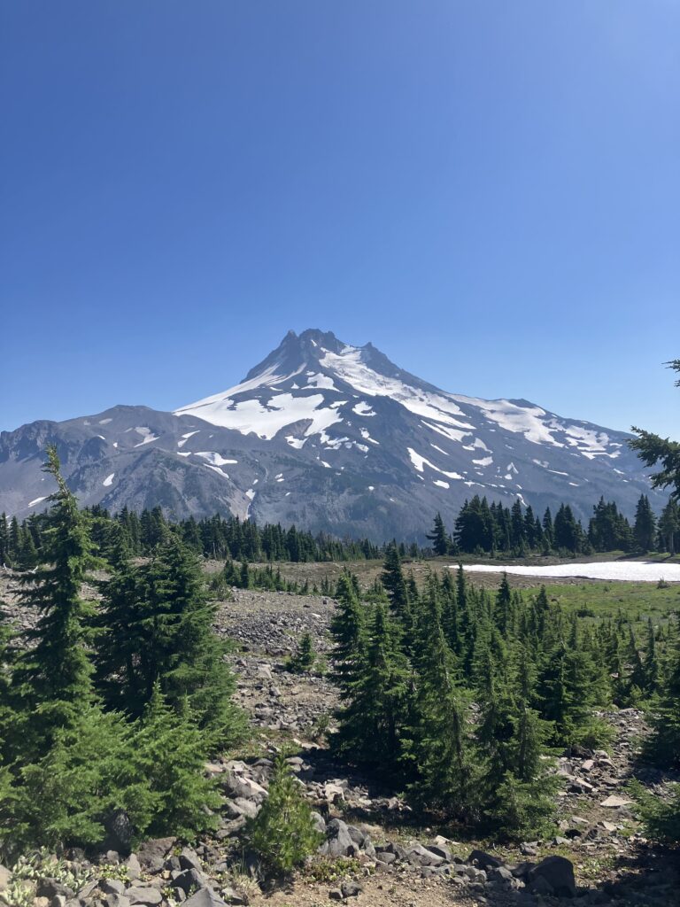
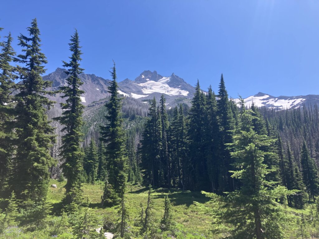
The next day, the trail climbed further to an area at the base of Mount Jefferson called Jefferson Park. Thankfully, this part of the forest hadn’t been burned and was still a pristine area of meadows, flowing creeks, and evergreen trees, all in the shadow of the enormous, snow-covered Mount Jefferson. Though it was only a few miles, this was one of my favorite sections of the trail so far, a really prime example of the beauty of the Cascades. Unfortunately after that high point came another low point. Coming down from the mountain, the trail went into one of the longest burn areas in Oregon, 14 or so miles. Other burn zones had been bearable because they weren’t very long or because there was other scenery in the area. But this one was just boring, ugly, blackened trees that went on for far too long and was full of pointless ups and downs. I was abruptly very over it and sad all over again that each year, more of the trail looks like this. I finally made it out as it was getting dark and found a place to camp under alive trees that probably weren’t going to fall on me.
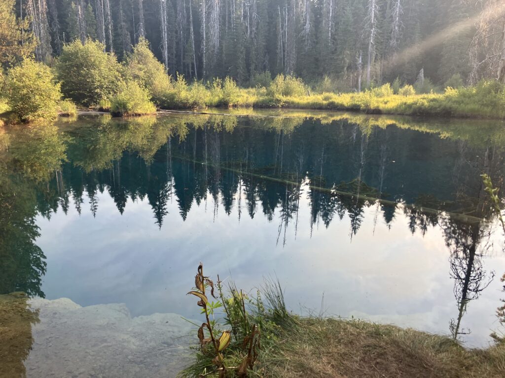
From around here was where most people did their 24 hour challenge, basically trying to get as close to Timberline, the famous ski lodge on Mt Hood which was still nearly 50 miles away, as possible in one day. The next 40 miles had minimal elevation change and were good trail – no lava fields, no trees to climb over. If I was going to do a 50 mile day in Oregon, like that one guy had predicted, now was the time. However, there are a lot of things that I feel like I could do if I wanted to, but when it comes down to it, I just don’t want to. So instead I did a long-ish but pretty normal and uneventful day, camping around 14 miles before Timberline and ready to get there reasonably early the next day. It was a little funny, after months of being the one who was doing long days and pushing ahead of people, to suddenly see all of these people rushing ahead. I did make a brief detour to see an extremely odd pond called Little Crater Lake – it might have more appropriately been called Micro Crater Lake, given their respective sizes. Having missed the real thing, I figured I might as well go see the miniature, and it was indeed quite deep and quite blue. Not quite as impressive though, I would say.
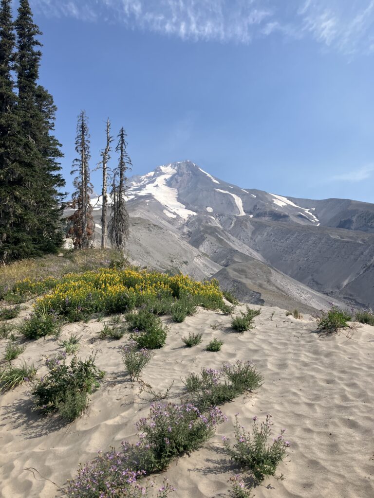
It was at and on the way into Timberline that things started to unravel. The hike into the lodge was beautiful, with great views of Mount Hood. The last mile of trail did feature a return of my nemesis, sand, but I managed. On the other hand, I showed up to claim my package, which Ben had sent with my last pair of shoes and a few extra snacks for the next two days – and the package was nowhere to be found. I checked all over the lodge complex but all my tracking info told me was that it had been delivered to “front desk/reception” somewhere in Rhododendron, Oregon. Where, exactly, I could not tell you. I called the town post office several times to try to find out where they might have brought this box, what other Timberline it had gone to, other than the extremely obvious one, but no one ever answered. Eventually I gave up and decided to scuttle the box – I would live without the extra food and I would soon be in Portland, where I would certainly be able to buy shoes. This was an unfortunate hiccup to add to my already fraying mood. A new fire had broken out in Washington, it was growing fast, and due to its location and the accessibility of services (or lack thereof) around it, it was effectively cutting off 150 miles of trail. Adding this to several fires in the northern part of the state, which I had vaguely hoped might get better, but had, if anything, gotten worse, only about 200 out of 500 miles of trail in the state were actually open and accessible. This wasn’t really a great way to end a thru hike. A lot of hikers were already planning to end their hike at Cascade Locks and come back to do Washington another year. Two days out from Cascade Locks, I was suddenly faced with having to figure out what to do for myself in a very short amount of time.
The next day brought more drama. I had planned to have an easy day, so I hadn’t gotten a particularly early start. I was hiking down into Lolo pass, the last road before Cascade Locks, when another hiker came up and told me that Eagle Creek, the trail into the town, was closed. There was a fire nearby, and the PCT itself had been closed for weeks, but Eagle Creek was a popular alternative, with a number of prominent waterfalls, that many hikers took anyway and was now the official reroute. If that too was closed, there was no way into town and the upcoming road was the last chance to get off the trail. This hiker claimed that there was now a sign at the junction and a forest service agent turning hikers away. He went on his way, and I still had a bit of service, so I checked for updates to the closure but couldn’t find anything to back up what he’d said. At the road, there was a guy doing trail magic, who was also passing on what the hiker I’d seen had said about the trail closure and who said he’d be able to shuttle people to a nearby town where there was a bus to Portland. A few more hikers arrived and no one was really sure what to do – we were being forced to cut off so much of our hike already, we all just wanted to at least get to the Washington border. Finally, some southbound hikers arrived, and when we asked about the trail, they said it had been fine yesterday. That was all some of us needed to hear to set off on what I’d been inclined to do anyway – I’d hike to the trail junction 13 miles ahead and if it was open, great; if it was closed, I’d just hike back to this road. I had nothing but time at this point anyway. A bunch of us hiked fairly quickly to the junction – if it wasn’t officially closed yet, but they were going to close it, maybe we needed to get down the trail as soon as possible? But, when I got to the junction, there was – nothing. No sign, no forest service guy, no evidence of current or imminent trail closure. We had all freaked out over nothing, on the word of some guy (who knows why he thought the trail was closed). I went back to my original plan of having a chill day.
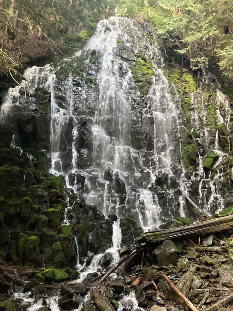
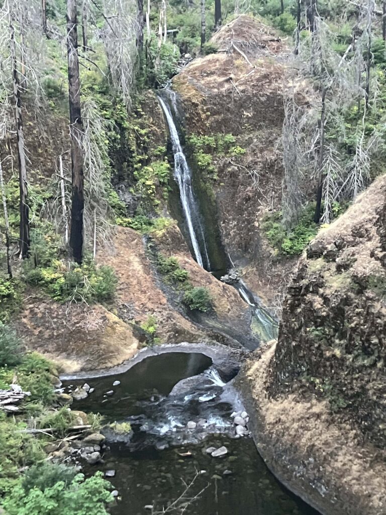
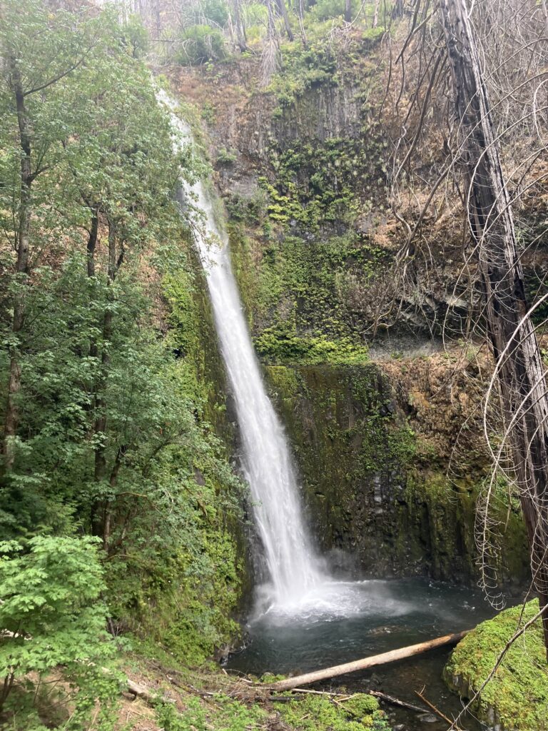
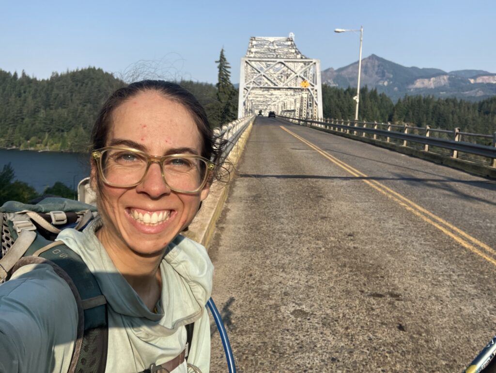
I’d heard a lot about how cool the Eagle Creek trail was, and it was cool, but no one had mentioned that the whole thing was burned. One last burn to say goodbye to Oregon. This was apparently from a 2020 fire, which was started by some kids setting off fireworks. So that put a bit of a damper on the experience. There were several beautiful waterfalls along the way, most notably Tunnel Falls, where the trail follows a cliff edge through a tunnel behind the waterfall. This was a popular day hike destination, and as I was walking leisurely to camp, a number of harried day hikers kept asking me “how far is it” with no context or explanation, and I was mildly concerned for them all, being out here, 6-7 miles from the trailhead, around 7pm. In the morning, I finished making my way into town. Since I was likely going to end up skipping ahead on the trail from Portland, I went to the grandly named Bridge of the Gods and walked across the river into Washington. (Hilariously, for being a key part of a famous footpath, the Bridge of the Gods has no sidewalk.) Then I turned around and walked back. I had made it here from Mexico, there was no way that I wasn’t going to walk across the Columbia. Then I set up at a coffee shop to call Ben and start figuring out the next few weeks. All of our plans for the end of the trail didn’t really make sense anymore, so it was time for new plans (this is why you shouldn’t make plans).
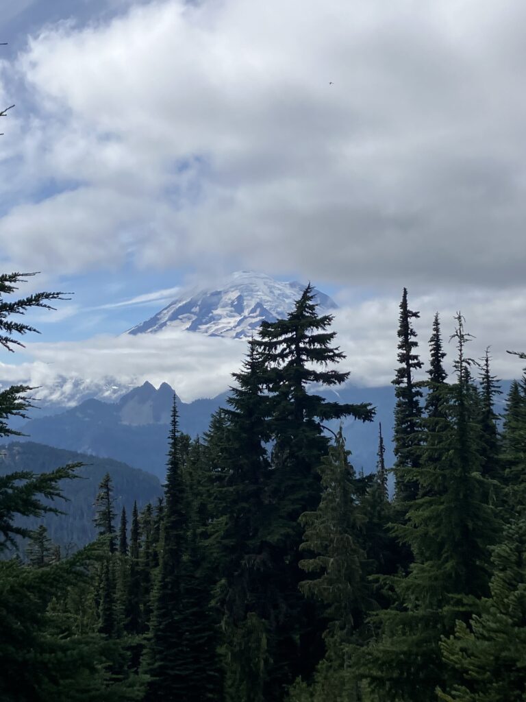
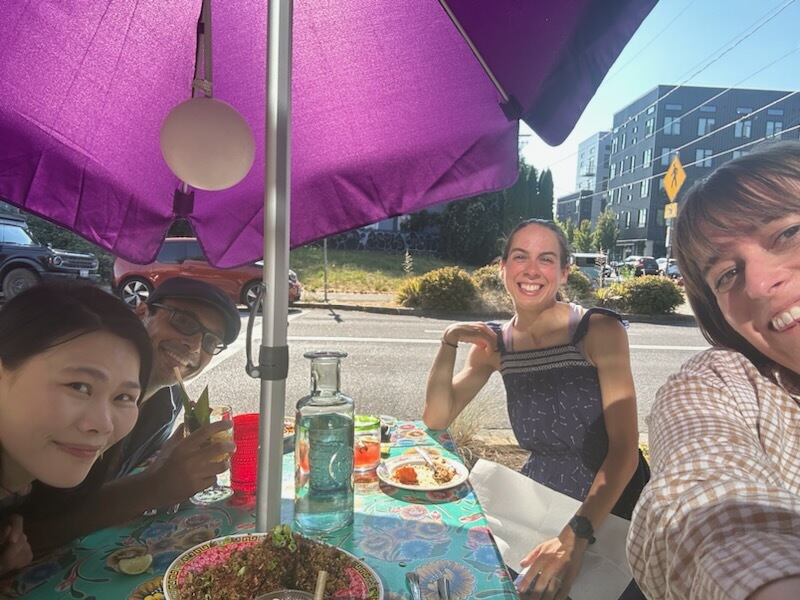
Midday, I took the bus into Portland (on this bus were about eight PCT hikers and two tourists), where I was actually getting to see people I knew for once. Two of my friends from work live in Portland and were happily available to have dinner and hang out with me for a while. Krishna and Hannah had also graciously agreed to pick me up from the bus station, so I was really living the high life now. I did manage to get new shoes, at a running store that also had a bar in it. We had pre-dinner ice cream and then went to dinner at an awesome spot that did Thai-Barbecue fusion and was extremely delicious. On the trail plans side, I had gotten a train ticket for the next day up to Centralia, Washington and arranged a ride from there to White Pass, the closest easily accessible trailhead on the north side of the fire closure. I also decided that I would go over to Mount Rainier when we passed near it and try to get walk-up permits to do the Wonderland Trail, a 93 mile loop around the mountain. This meant packing out four extra days of food (for a total of eight days, yikes). If it didn’t work out, well, I would just have carried a lot of extra food for no reason.
The train the next day went pretty smoothly, and there were several other hikers on it. A few of the others were getting the same ride as me, and we hung out in the train station waiting for Tim, the trail angel giving us a ride, to get there. We did note that there were five of us there and we had thought he only had space for four, but we’d cross that bridge when we came to it. Sure enough, when Tim arrived, he was surprised that there were five of us – he’d accidentally put down a pair of guys as just one person, not two. We didn’t want to strand anyone in Centralia, though, and after months of hiking, it’s not like any of us were particularly large, so we gamely squeezed four people in the back and set off on the nearly two hour drive to the trail. It was clear as we got closer that we were really in the middle of nowhere, and since the road we were on was closed to the east basically at the trailhead, there was very little traffic. Tim dropped us off at the small, hiker-friendly general store where the road closed, and suddenly we were in the middle of Washington. As it was now 5pm, I grabbed a quick dinner from the store and hung out in front with two of the guys I had ridden in with. We discussed our general angst about Washington and skipping so much trail. Some people were hiking around the fire to the south on forest roads, and I had considered it, but ultimately it felt irresponsible. Who knew what the fire or smoke would do in the coming days, and if something were to go wrong, you’d just be creating an additional problem in an already strained area. Plus, as one of the guys pointed out, we might as well do the parts of the trail that were currently safe and open before they too were on fire.
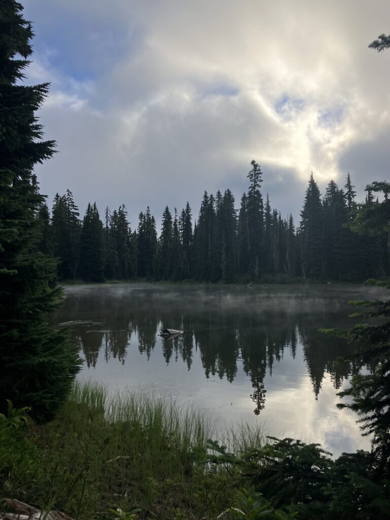
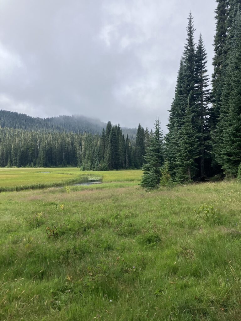
Eventually, I left the store and hiked a few miles before setting up camp for the evening, my first real Washington miles. The next day, I had an extremely leisurely day, with just nineteen miles to the campsite that I wanted to stay at near Chinook Pass, where I’d get off to go into Mount Rainier the next morning. It turns out, at thru hiker pace, nineteen miles is really too few miles to fill a day, and I took a lot of very long breaks, barely knowing what to do with myself. I met several weekend hikers who, on hearing how many miles I’d done so far in the day, told me I was “really moving” though I would have described what I was doing as more like moseying. At least there was beautiful scenery and it was a perfectly nice area to meander my way through. Eventually I set up near a pretty, and popular, lake and got ready to get up early and see if my detour would work out.