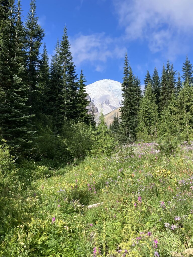
Just south of Chinook Pass, I got up super early so that I could get to the road and try to get into Mount Rainier National Park and to the ranger station as early as possible. I got to the pass around 6am, arriving to beautiful views and a sign signaling entry into the park. As many who know me are aware, I am mildly obsessed with Mount Rainier. It is one of my favorite places and by far my favorite mountain. Mount Rainier is the most prominent and the most glaciated peak in the contiguous United States, and both of those things mean that if I were to say “imagine a huge, impressive mountain” the image you conjured would probably look a lot like Rainier. As I’ve been hiking through the Cascades, part of me thought, well, all of these mountains are large and impressive, perhaps I’ve been building up Rainier too much in my head. But no, upon seeing it again, it truly is just a massive mountain, much larger and more imposing than the other peaks the trail goes by. It is about 100 feet shorter than Mount Whitney, but they couldn’t be more different. Whitney is part of a range and you could barely tell what the peak you were aiming for was until you were on top of it. Rainier is an isolated giant that dominates an entire state. While it was cool to very briefly be the tallest person in the US outside of Alaska on top of Whitney, it is, let’s be honest, an extremely lame mountain compared to Rainier. Unfortunately, I could not just pop up to the top of Rainier (I already have one failed summit attempt under my belt), but I could spend a few days hiking around it.
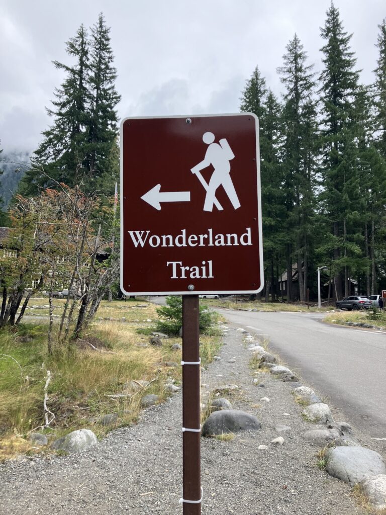
Fortunately there was some early morning traffic going into the park. Rainier is one of many parks that have started doing timed entries by reservation during peak season, in this case from 7am to 3pm. That meant that there were people going into the park before 7am to avoid needing the reservation. I was picked up by a kind, older man on his way to Sunrise, and we discussed our Rainier experiences. He had successfully summited once in the seventies and said it was “absolutely horrible, very cold and windy.” He dropped me off at the ranger station and wished me luck on my permit attempt. Most backcountry camping permits were reserved in advance, but some were held for walk-ups, which is what I’d be trying for. You can get a walk-up permit at any of the wilderness ranger stations, and while the one I was at wasn’t very busy, the ones at Longmire and Paradise frequently had lines by the time the office opened. Luckily I didn’t have this issue, and got to a ranger right when they opened. I explained that I was a PCT hiker, looking to get a camp itinerary to do the Wonderland Trail in four days or so. She confirmed that I’d looked at the elevation profile and was aware that the trail was generally steeper and had much more elevation change than the PCT. The first night was the hardest, as there wasn’t much available, but there was a camp slightly off the trail and after some quick calculation, I told her I could make it there. The next nights were easier, though my first pick of camp for the second night ended up getting taken by someone at another ranger station. (“It’s a race every morning,” said the other ranger.) I was worried that would keep happening, but after picking a new camp for the second night, everything went through on the second attempt. Just like that, I was set to do the Wonderland Trail. One interesting feature of the booking system is that even if all the permits had been available in advance, I wouldn’t have been able to book this itinerary myself – recreation.gov won’t let you book sites that are more than seventeen miles apart for subsequent nights on the trail. The ranger can override this limit on a case by case basis. My permit had a note on it that said, “PCT hiker – has been advised of long mileage and excessive elevation each day.”
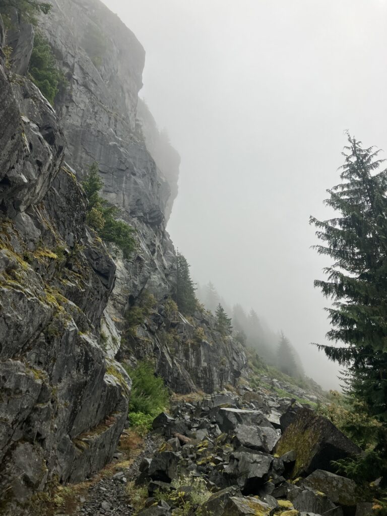
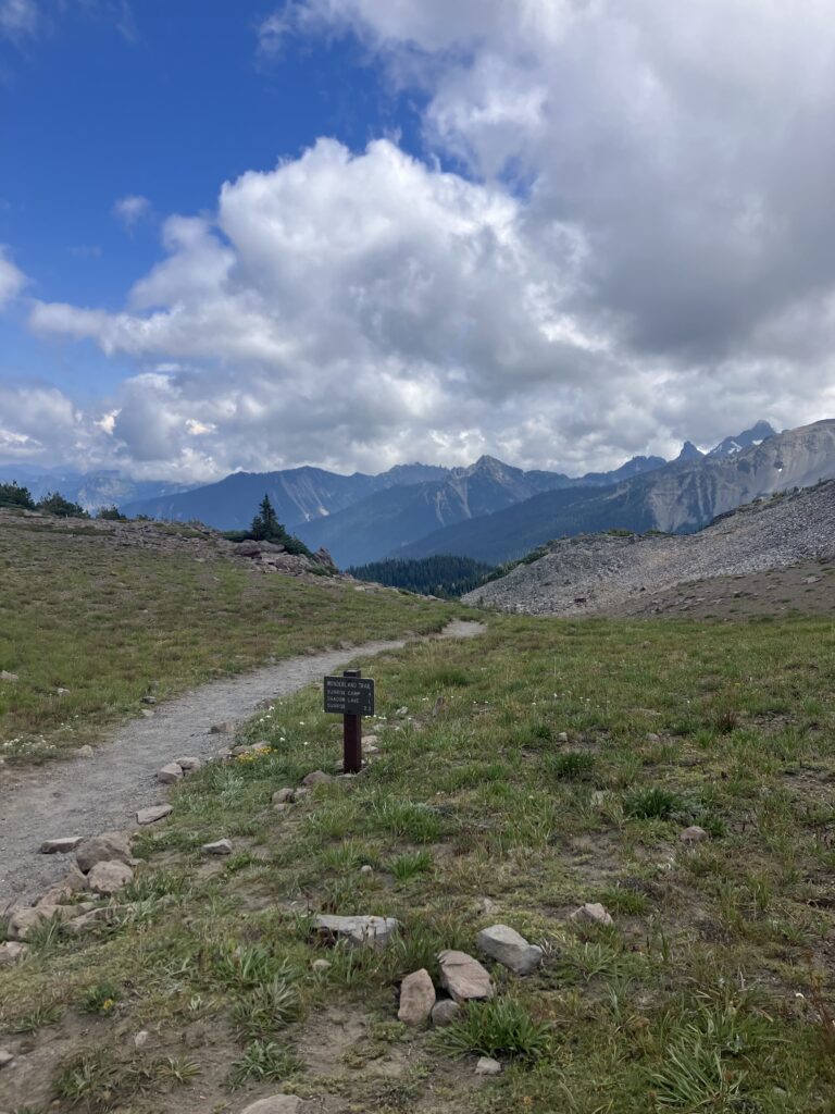
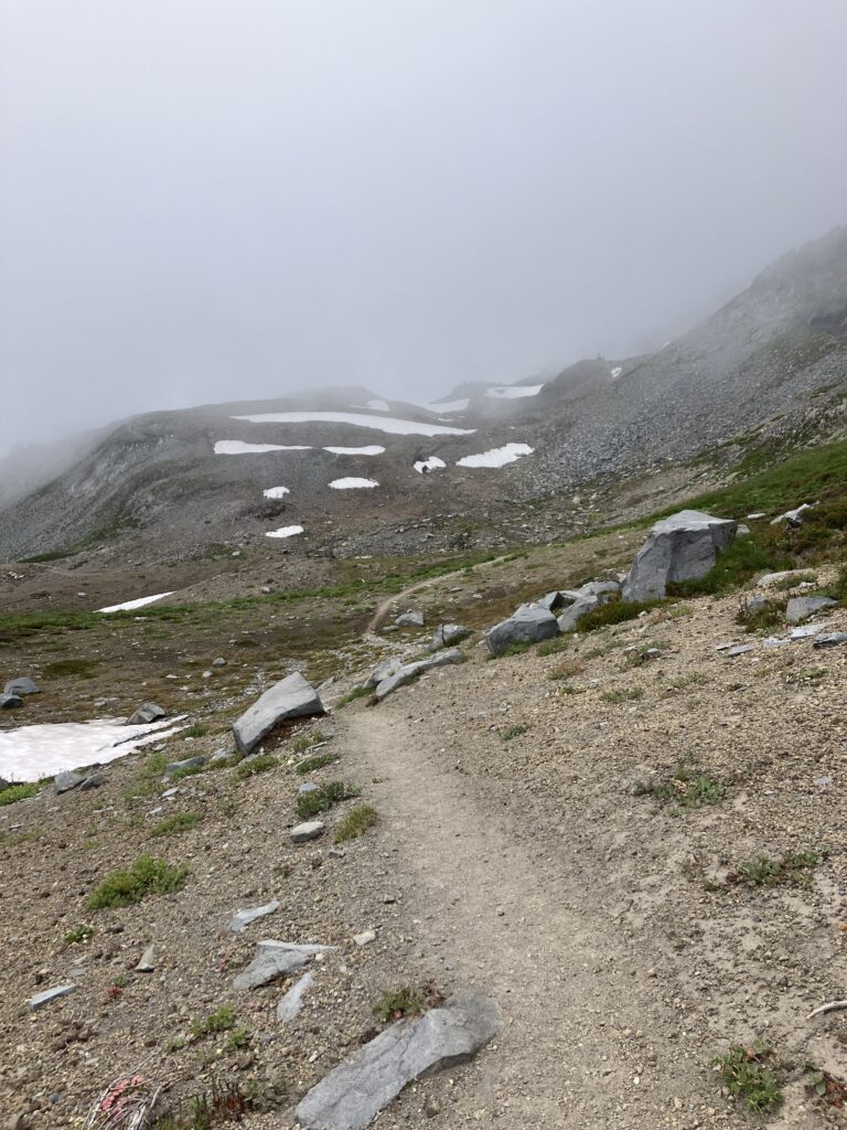
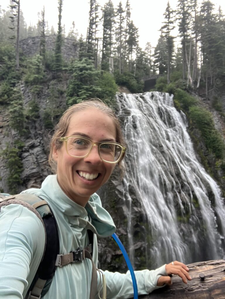
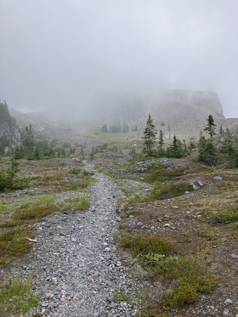
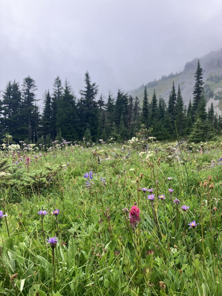
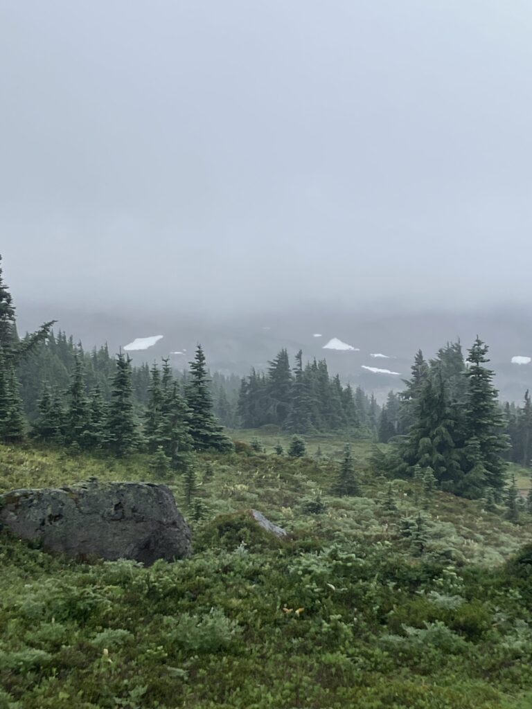
The actual trail was another few miles up the road, but luckily I quickly found a ride with one of the volunteers at the ranger station. Then I was setting off towards the mountain. While it was true, as I’d told the ranger, that I had looked at the elevation profile of the trail – it was spiky – I had not exactly memorized it, and I realized belatedly that the paper map I’d grabbed from the ranger station didn’t have one. So I knew I was starting out with a climb, but how long and how steep was anyone’s guess. Quite long and quite steep, it turned out! It started mildly enough, but soon I was climbing into one of Rainier’s famous meadows, Summerland Meadow, where I got some of the best views of the mountain that I would end up having. One of the trail’s most popular campsites was here, and it had been the destination on all the signs until now, so I thought that perhaps this was the top of this particular climb. It was not at all, in fact. The trail kept climbing, out of the subalpine meadow and into true alpine landscape and also into the clouds. Even though there weren’t views, I’ve always liked being in alpine zones in the fog, it’s a very cool and eerie landscape. I passed by lakes and waterfalls and soon climbed over Panhandle Gap, the actual top of the climb. Things did not immediately get easier though, as the trail continued to meander through the alpine zone and then through another meadow, often going over short, but very steep, ups and downs. I stopped to get water and noted that it had taken me a pretty long time to cover nine miles. Perhaps I had made a huge mistake and could not actually cover the distances I had told the ranger I could.
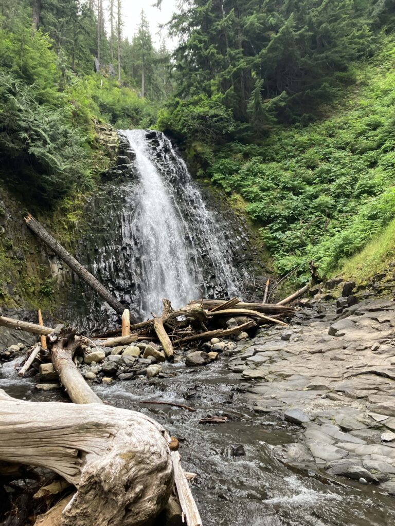
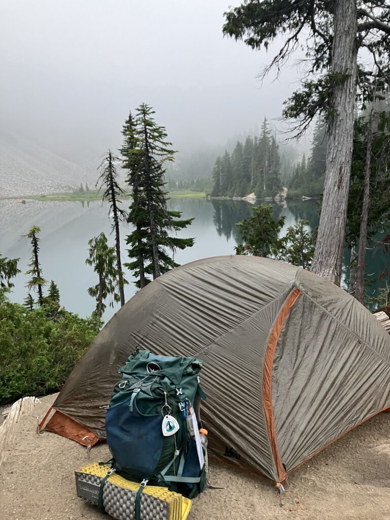
Fortunately, the trail chilled out quite a bit after that and I started making better time. (This first section actually turned out to be one of the steepest and most aggressive of the entire trail, so I started strong.) The trail went down for a long time, coming out to cross a river, and the road, at Box Canyon. The next section followed Stephen’s Creek through a canyon, paralleling the road for several miles. The ranger had warned me that there was a short section where the trail had washed out. There was a flagged reroute in the scree, or I could just hitch around the whole section on the road. Given that it was already 4:30, it was tempting to hitch around. But, I didn’t skip Mission Creek, I wasn’t going to skip this. I was glad I didn’t, as the whole washout section was about half a mile and took maybe 15 minutes to get through. Along the rest of the trail, there were several nice waterfalls that it would have been sad to miss. My camp for the first night wasn’t technically along the trail, so when I met back up with the road, I walked a short way along it to the Snow Lake trailhead and then up a short, 1.2 mile trail to the lake and the camp. Considering that you could have parked at the trailhead and walked approximately one mile to this campsite, I think that this is one of the best bang for your buck backcountry sites I have ever seen, and I was shocked it wasn’t more sought after. There were just two sites at the camp, spread out so that you couldn’t even see one from the other, and both were right on the pristine, blue alpine lake. No one was even at the other site, so I had the lake all to myself.
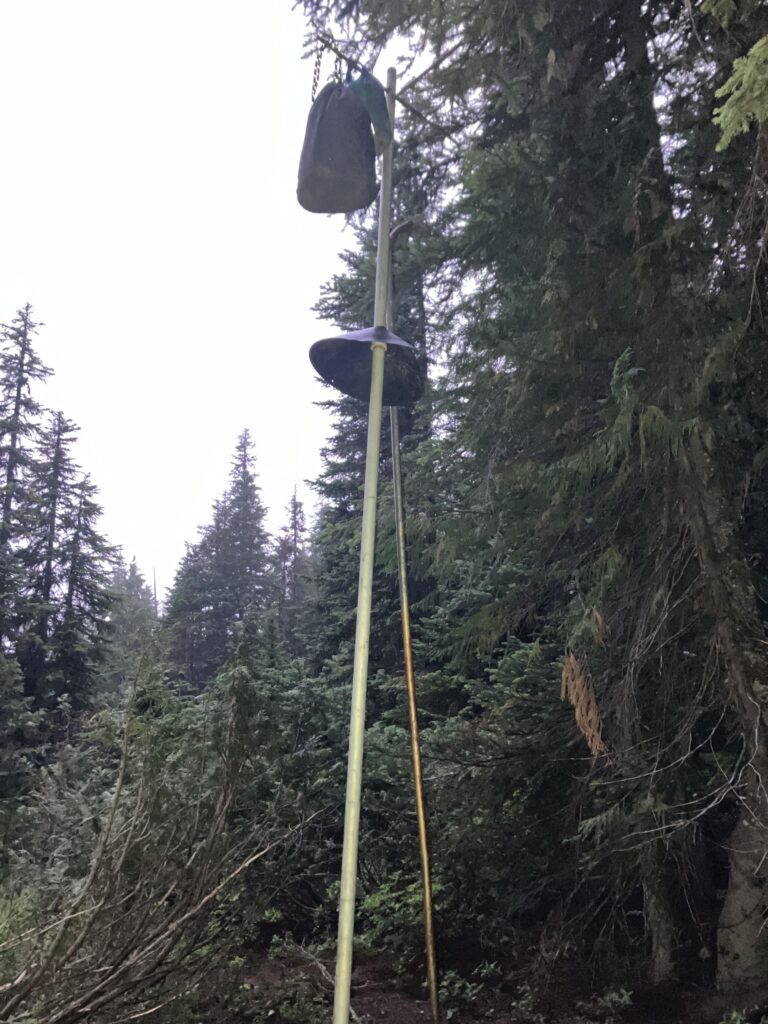
Another highlight of the Wonderland Trail was that it marked the Return of the Bear Pole. I LOVE bear poles. Not because they are the easiest or most convenient way to store your food; they are 100% not that. I just think they are hilarious. A bear pole is pretty much what it sounds like – a ten foot pole with hooks or bars at the top that you hang your food bag from, stopping bear and other critters from being able to get to it. The way that you get the bag up there is by using another tall metal pole to lift the bag up and transfer it from one pole to another, ten feet in the air, like some kind of demonic carnival game. The only other place I have encountered bear poles is in Virginia, in and around Shenandoah National Park. The first camp I came to that had one, I arrived pretty late and in the dark. I spent a very long time trying to get my bag onto the pole, in the dark with my headlamp’s red light, wondering if I was doing something wrong, before I finally got it. I determined later that I wasn’t doing anything wrong, it was just really hard. For the rest of that section, it was the nightly entertainment, watching people trying to hang their food on the poles. The ideal scenario was that you, a thru-hiker, hooked your bag on the first try and could then make fun of the weekend hikers struggling. In truth, we all struggled most of the time, and you just had to hope there were no weekend hikers around to witness it.
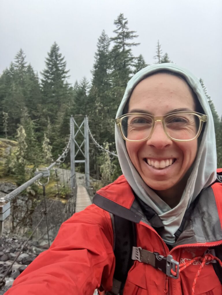
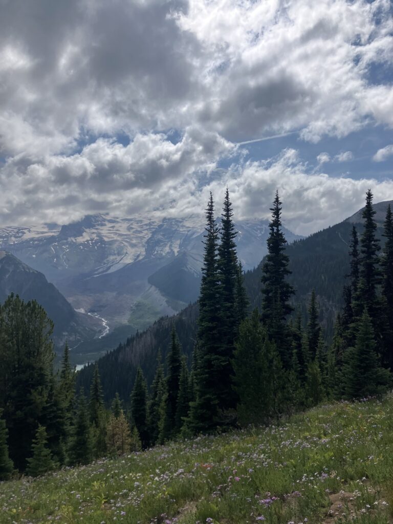
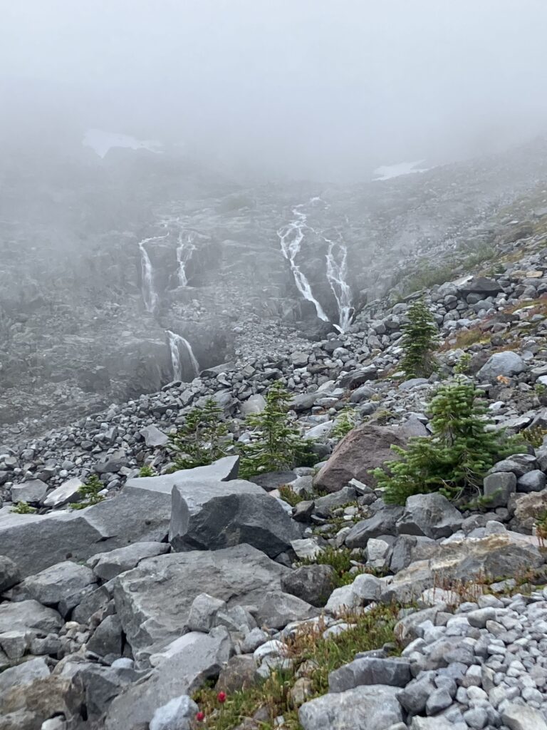
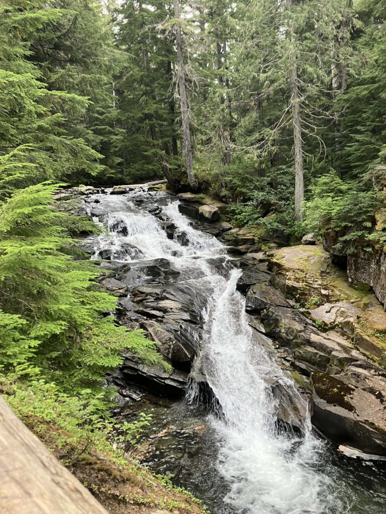
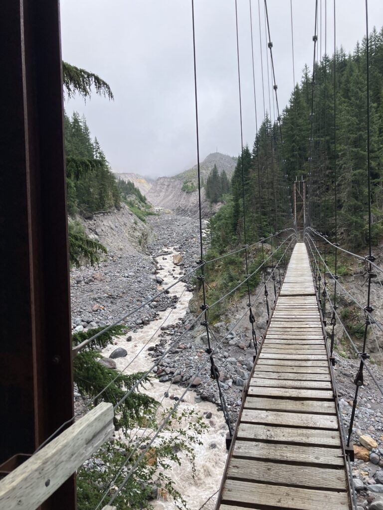
The next morning I made my way down to Longmire, one of the main visitor centers in the park, passing some more waterfalls along the way. I took the opportunity to connect to the WiFi in the ranger station and download an elevation profile for the trail. While it is fun to be surprised, sometimes it’s also good to know what’s coming. That was the easy part of the day. The elevation profile of the trail is so spiky because it alternates between climbing up over the mountain’s ridges and descending to cross one of the many creeks and rivers that originate from the glaciers. On the west side of the mountain, this happens several times in quick succession. It was still quite cloudy so this also meant climbing in and out of the clouds. The high ridges continued to have an eerie quality in the fog, while the rivers rushed with such an impressive volume of water it seemed vaguely implausible that there could be any glacier left. Tacoma Creek featured one of the most impressive trail bridges I’ve seen, a 200 foot long suspension bridge some 80 feet above the creek. The bridge moved quite a lot as I walked across it and probably wouldn’t be thrilling for anyone with a fear of heights, particularly near the far end where some slats were missing. I camped that night near the Puyallup River, and while it wasn’t quite as picturesque as Snow Lake, it was another nice, isolated spot with the rush of the river acting as a nice, natural white noise machine.
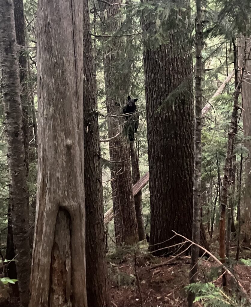
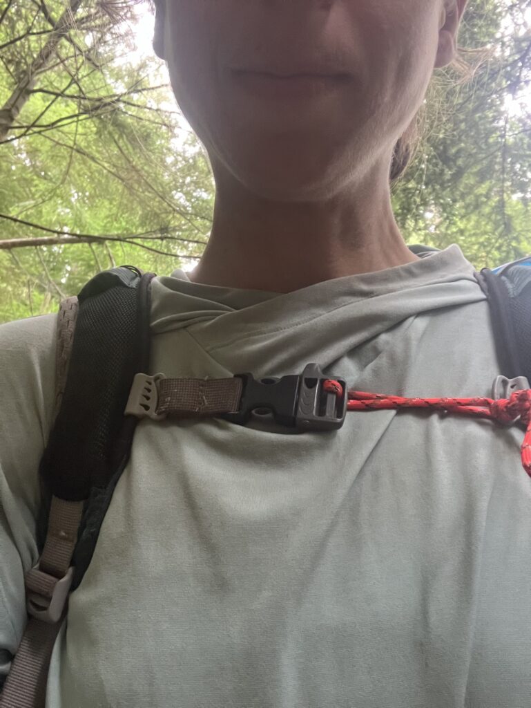
Due to campsite availability, days one and two were longer than days three and four, and by now I’d grown used to the steeper trails and was confident I’d actually make the miles each day. So the next two days were pretty chill, all things considered. As I made my way up another cloudy ridge on day three, I saw my second and third bears of the trip, both pretty far away, enjoying their natural habitat. I also had a minor mishap in the form of the chest strap on my backpack breaking. I have had this backpack for nine years and taken it on nearly 5000 miles of backpacking adventures, so honestly it is kind of a miracle it has lasted this long. I did my best to fix it up real quick, enough for it to make it 200 more miles or so.
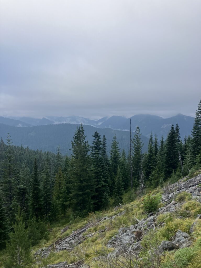
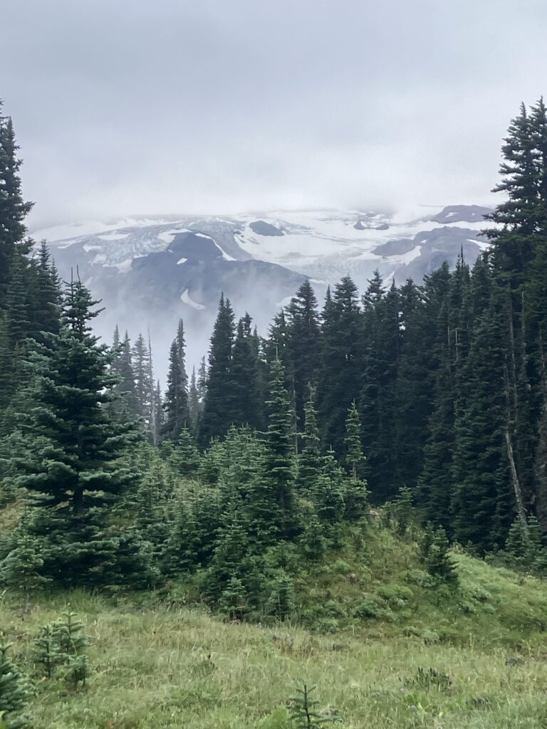
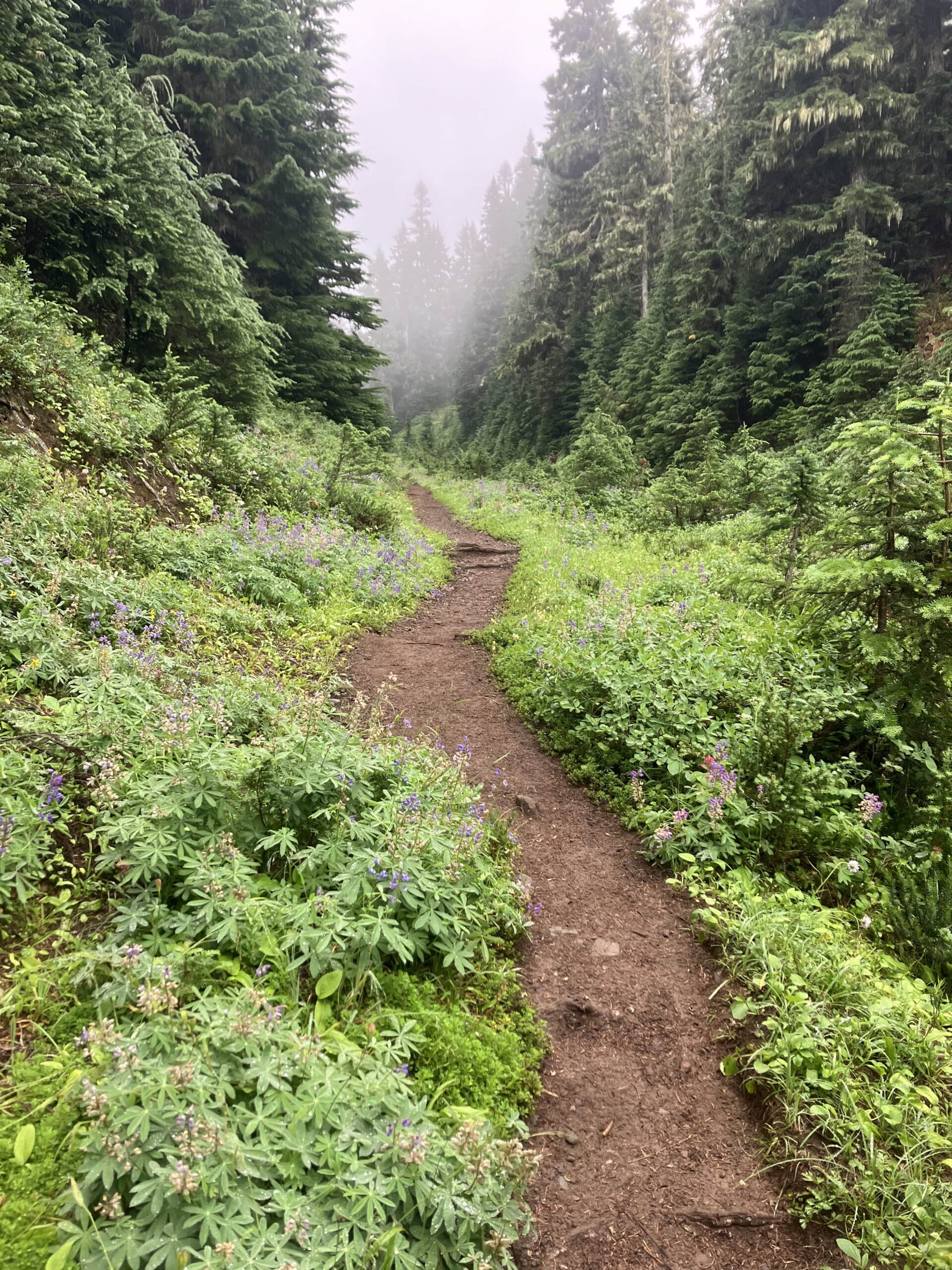
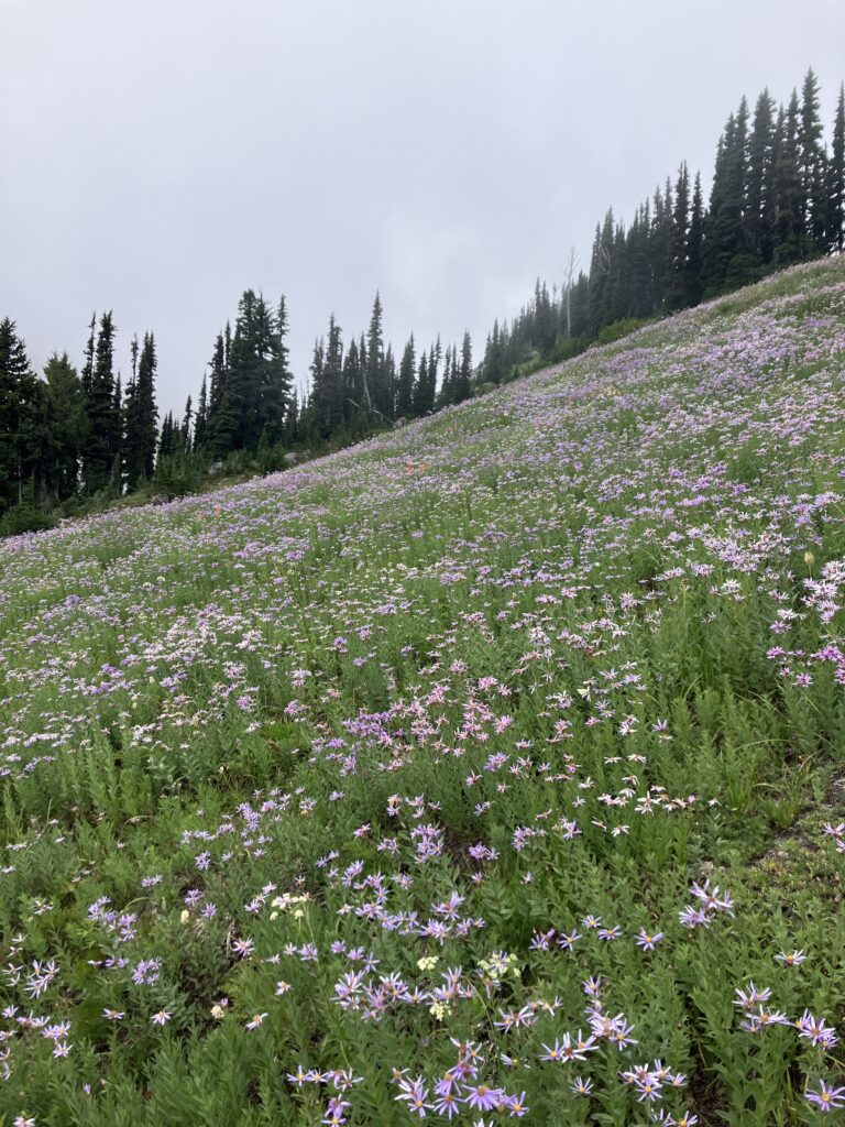
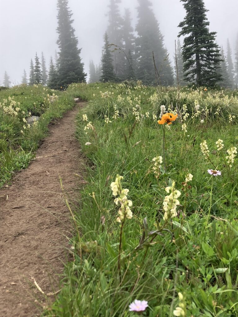
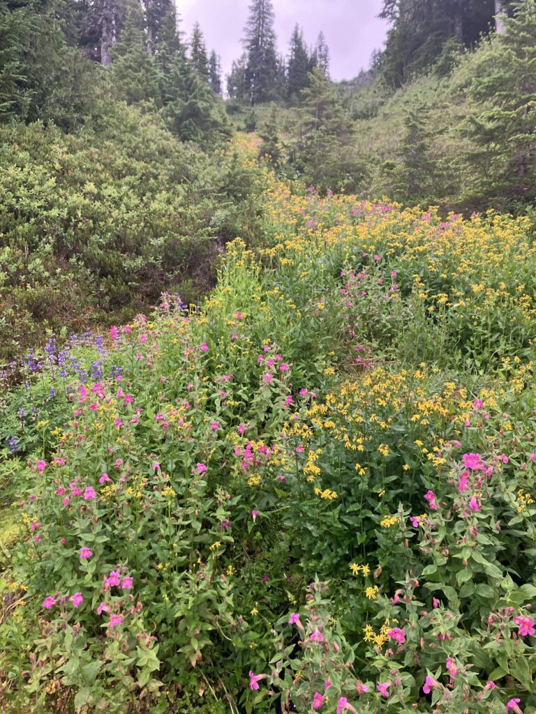
In the afternoon, I split from the proper Wonderland Trail – I had opted to do the “Spray Park Alternate” and my next campsite was along that trail. I did not 100% know what that meant, really, but I had heard of it and heard it was cool. Doubtless it was cooler when it was not in the clouds, but what can you do. (I did say that I missed rain and was tired of sun, and I was being rewarded with the most Washington weather possible.) Still, I got a little lucky and as I made my way through Spray Park and Seattle Park on the other side of the ridge, I was in a space between clouds. I still couldn’t see the mountain, but I could at least see what was around me. There was an abundance of wildflowers in these subalpine and alpine zones, and the clouds above and below made it feel like I was in a liminal space. While I’d love to go back in clear weather, I didn’t feel disappointed in this trip.
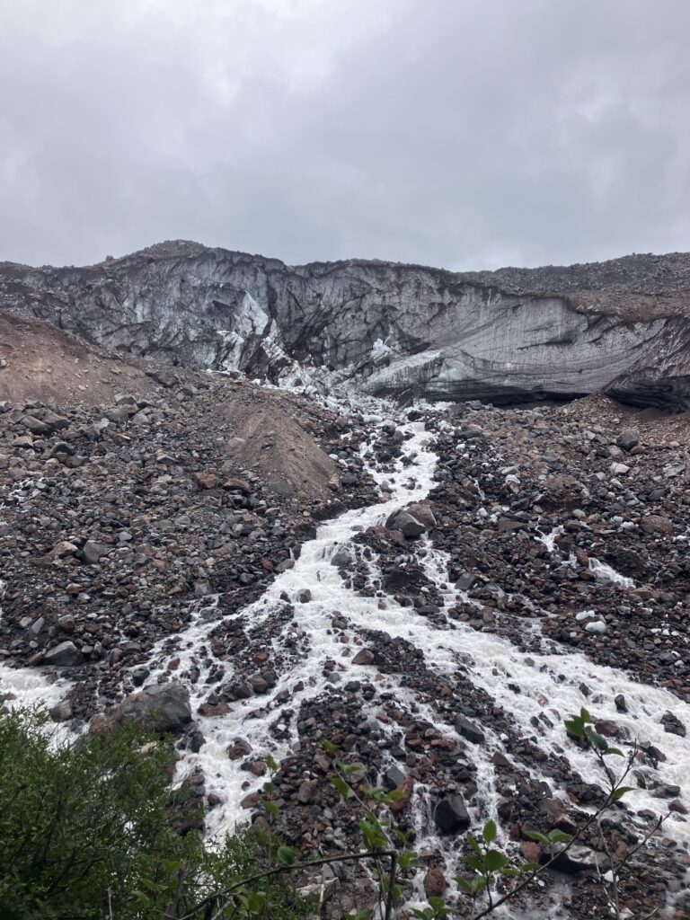
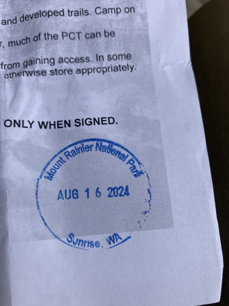
On my last day, I circled back to the north and east side of the mountain, typically the clearer side, and I did indeed have fewer clouds and more views. I spent the morning making my way around the Carbon and Winthrop glaciers, with great views of both. With its toe at an elevation of just 3500 feet, the Carbon Glacier is the lowest glacier in the contiguous US. As I made my way around the rock fields on the eastern side of the Winthrop Glacier, it felt like I suddenly turned a corner and was back in the sun. I also suddenly turned a corner and was engulfed in tourists and day hikers. Given that I’d been doing most of the trail during the week, it had been an extremely quiet journey. But now it was Friday, and I was just a few miles from the Sunrise visitor center. I meandered over to Sunrise, along with everyone else who was suddenly here, with the primary goal of getting a parks passport stamp. Ben has a rule that we only get stamps from places we have been together, but I stamped my PCT permit as a souvenir of my detour. As I walked over to the visitor center, the mountain was almost out, with just the summit in the clouds. But as I stood there watching, for just a second, the clouds broke a tiny bit and you could see the very top. I glanced back and saw an older couple who had been walking behind me, and the man gave me a silent thumbs up, acknowledging that for a moment, we’d gotten the whole mountain.