If you are thinking those mileage numbers don’t seem quite right, you are correct. I did not suddenly start hiking even faster, I skipped about 50 miles to go around a fire closure, which I will go into.
On the AT, everyone talks about how horrible Pennsylvania is, but I found it to be pretty fine – until the last 50 miles, which were godawful and made me understand why we all hated Pennsylvania. Northern California is kind of the opposite of that: it was not great for four hundred some odd miles, but the last two hundred miles were actually pretty nice. Having some genuinely nice days was critical – I’m not sure I could have taken another few hundred miles like the ones that preceded Mount Shasta. Sadly, a lot of hikers were still skipping the entire section of Mount Shasta to Ashland to go around the Shelly Fire – a fairly large fire, luckily contained now, near Etna, California. I feel bad for everyone who suffered up to Mount Shasta, only to skip this, the only good part of NorCal.
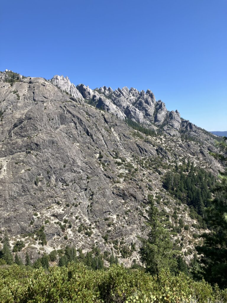
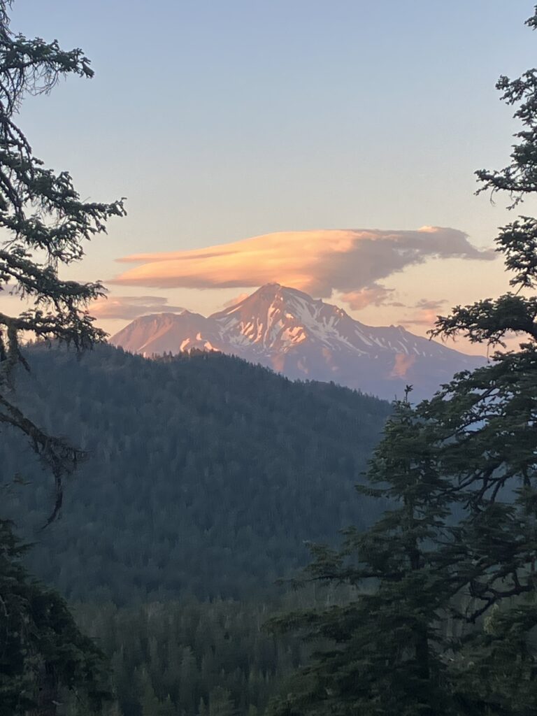
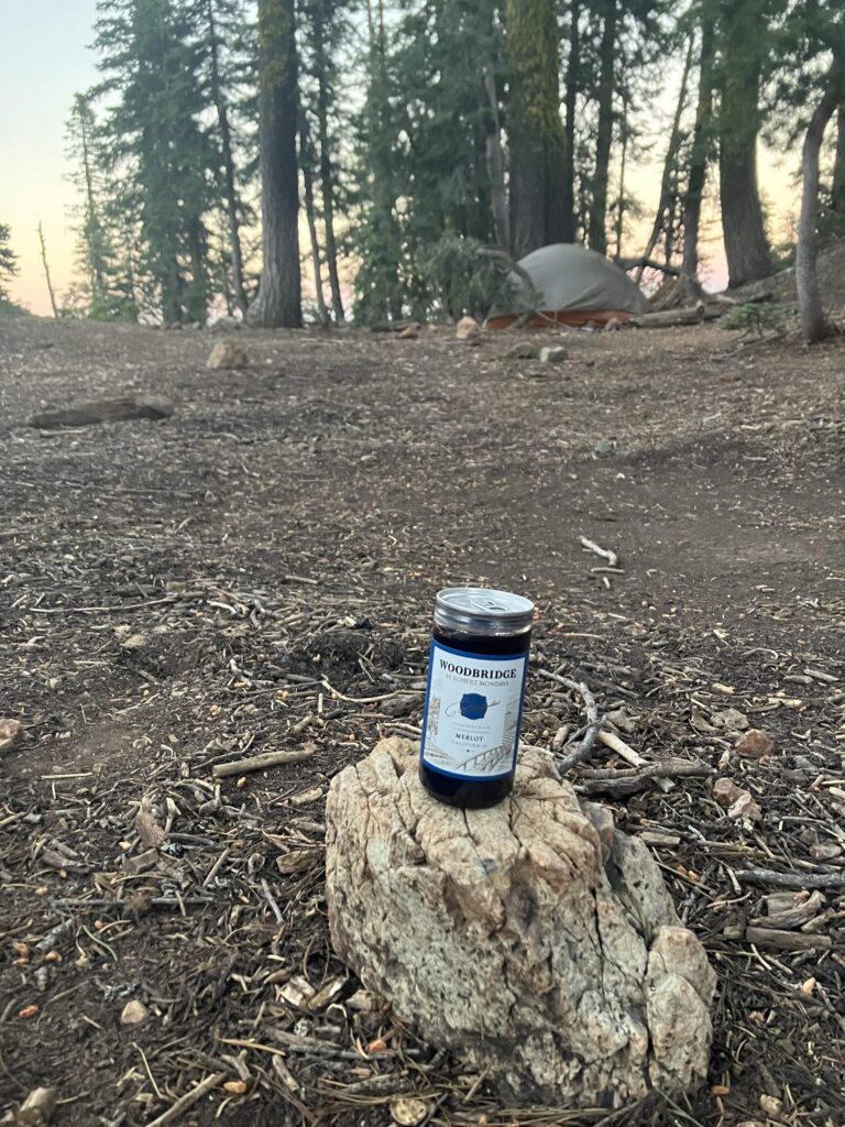
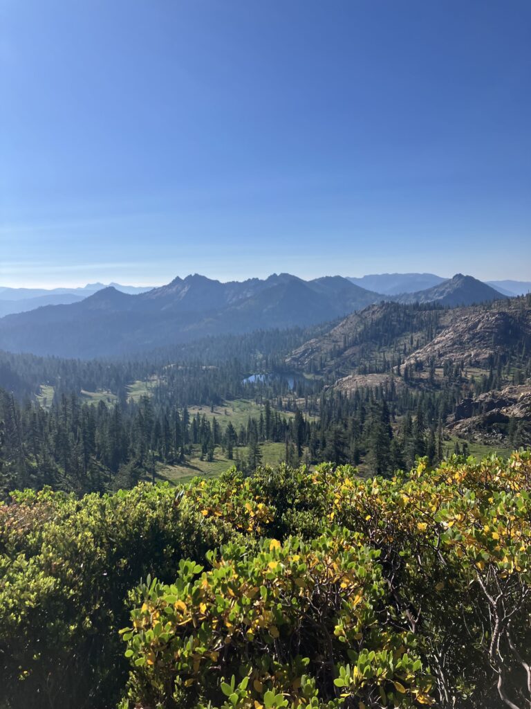
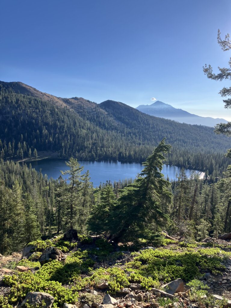
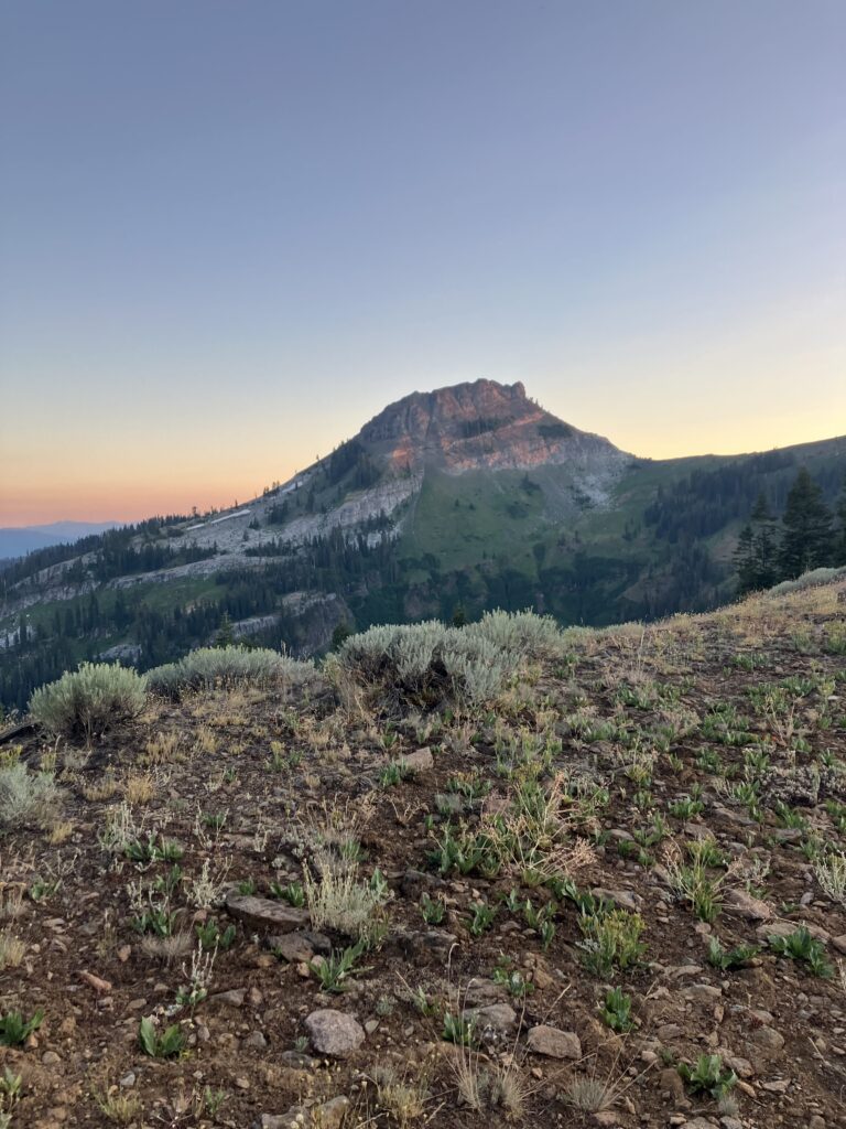
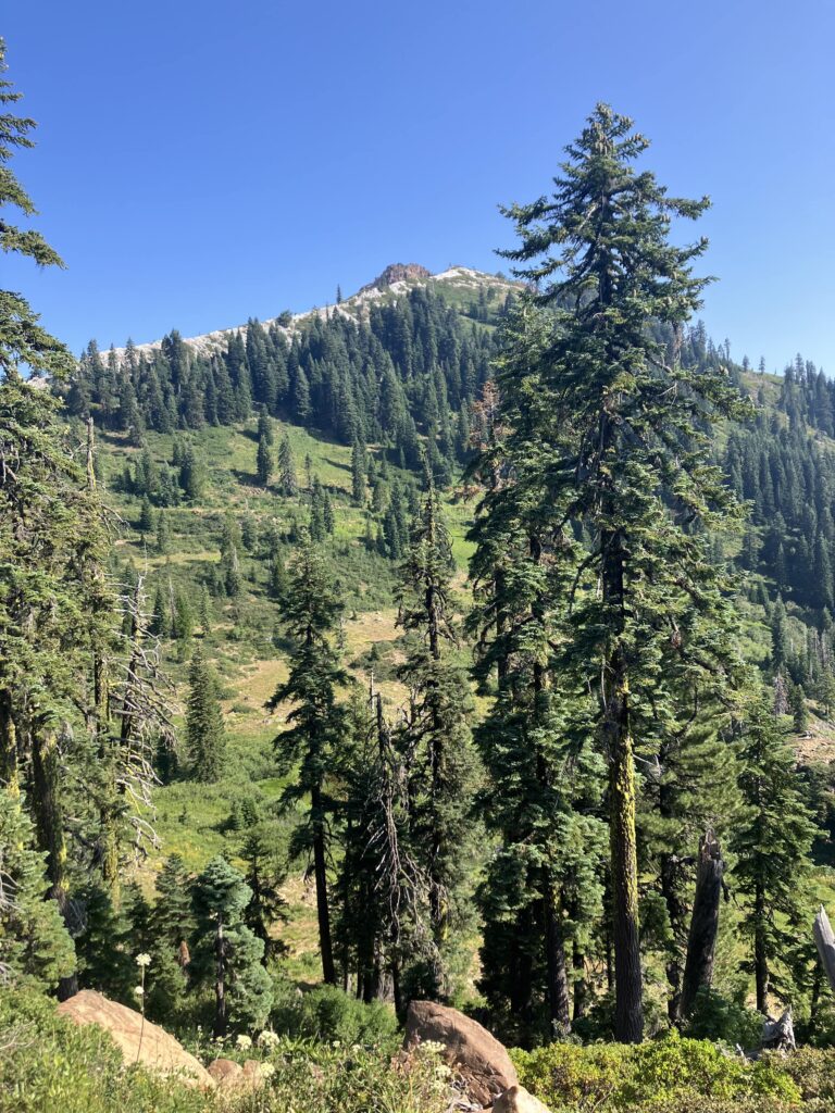
Leaving Mount Shasta, the trail went into Castle Crags State Park. Castle Crags is exactly what it sounds like: a bunch of craggy rocks that look vaguely castle-like. While the climb was, as per usual, hot, the scenery was at least nice. And then I was up on a ridge, the temperature was lower, there was a nice breeze and lovely views. I camped on a ridge with beautiful sunset views of Mount Shasta (the mountain). After the sort of terrible last week and a half, I had reverted to my AT hiker trash practice of packing our tiny bottles of wine to have something special with dinner. (I still vividly remember the weekend hiker in New York who stared incredulously at me and the other woman I’d been hiking with and said “This is what thru-hikers have for dinner? Peanut butter m&ms and wine??”) It seemed mildly more reasonable on the AT, where I had a stove, and could at least say I was having some wine with pasta, very normal. Here it was wine with janky tortilla wraps.
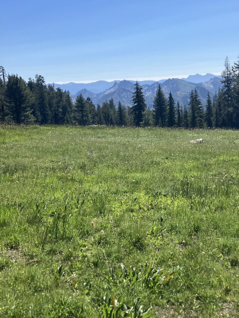
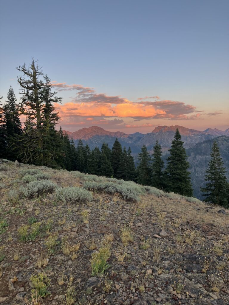
The next day continued to be not terrible. It was probably the most unambiguously nice day I’d had on trail since around 4th of July. There were beautiful views along ridges, the temperature was comfortable, the trail was well maintained and not completely overgrown. I easily hiked almost 35 miles without even getting to camp very late. I even saw my first bear of the trip in this section. It was during the day, not near camp, and it was running along, gone so quickly that I didn’t even manage to get a picture. The next day, I’d arranged a ride to go around the Shelly Fire. The trail was closed for about 27 miles. I had arranged the ride in Mount Shasta a few days before, to make sure I had a ride, and at the time, conditions in Etna had still been a bit iffy, so I had hedged and asked to be picked up at the trailhead before Etna, about 19 miles before the official closure. Now, it was clear that it would have been fine to hike to Etna, but I didn’t want to be rude and cancel my ride last minute or have to find another one. I decided I could live with those extra 19 skipped miles.
The way fire closures are handled and communicated has been one of my many frustrations with the PCTA. This closure was announced in early July, and then no updated guidance was given as conditions changed. For a while, when the fire was at its worst, it was unsafe to hike all the way up to the closure or to resume right where the closure ended. Then, things improved as the fire was contained, and it was safer again to hike more of the trail. But none of this was reflected in official trail closures or guidance from the PCTA, so hikers were left to make these decisions on their own. Ultimately, everyone was trying to do the right thing, but more guidance from the objective third party running things would have gone a long way.
I’d found my ride with Ann, a woman who had posted on the guide app all the hikers used, offering rides and support. I’d expected her to be middle aged or retired, as most “trail angels” who gave rides seemed to be, but she was probably 25 or 26. She’d lived in Etna for a few years and worked in water quality and testing. We spent most of the hour long drive discussing her work drama, which was refreshingly normal. The trailhead for the side trail to get back on the PCT was up a dirt road, and I had seen that some of the people giving rides wouldn’t drive up it and were dropping hikers off at the base, adding about 5 miles to the walk back to the trail. Ann, however, had no issues and drove me up until it looked like the road got significantly rougher, where I said it was fine to drop me off, though she seemed like she might have tried to drive up it. I found out the next day in fact that on her way down from dropping me off, she saw five other hikers who had been dropped off at the base of the dirt road, and she turned around and drove them up as well. They also said it was fine to get dropped off where I’d gotten out, but she apparently told them, “I think I can do it, let’s try” and barreled up the rough dirt road, dropping them right at the trailhead. The moral of the story is that Ann was a bro. I had no issues walking up the road and then a short trail, which had some really nice evening views, getting back to the PCT in under two hours. There were some tent sites at the junction and I probably should have just stopped there, as it was getting dark, but I’d seen that there were some sites another mile and a half north and decided to go a bit further. Unfortunately when I got there, there were no tent sites to be seen, and sure enough, when I checked the comments on the app, the first one was “there are no tent sites here.” So I guess I should have checked that first. Fortunately the next site was only a half mile further and this one did exist, so I quickly set up my tent in the dark and went to sleep.
After climbing back up to the trail, much of the next day was spent going all the way back down into a low river valley. Sadly, you could feel the temperature rise as the trail went down, but it was at least not quite as hot as the week before. Seiad Valley was a very small town, basically a general store and a campground, that the town went directly through. I started early in the day because I wanted to make sure I got there before the store closed (I needed just a bit more food to get to Ashland) and with enough time to do my laundry at the campground. The last seven miles into town were a road walk, which was easy enough, but unfortunately with the timing of the day, I was doing it in the afternoon, so it was very warm. I put on some music and powered through.
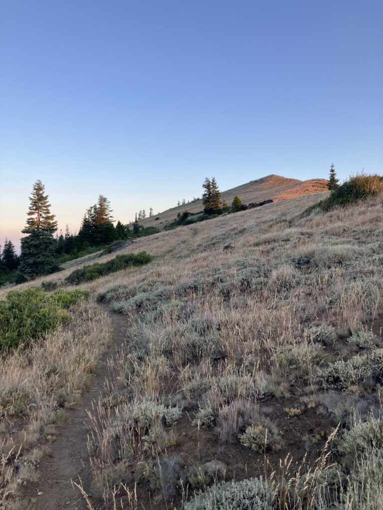
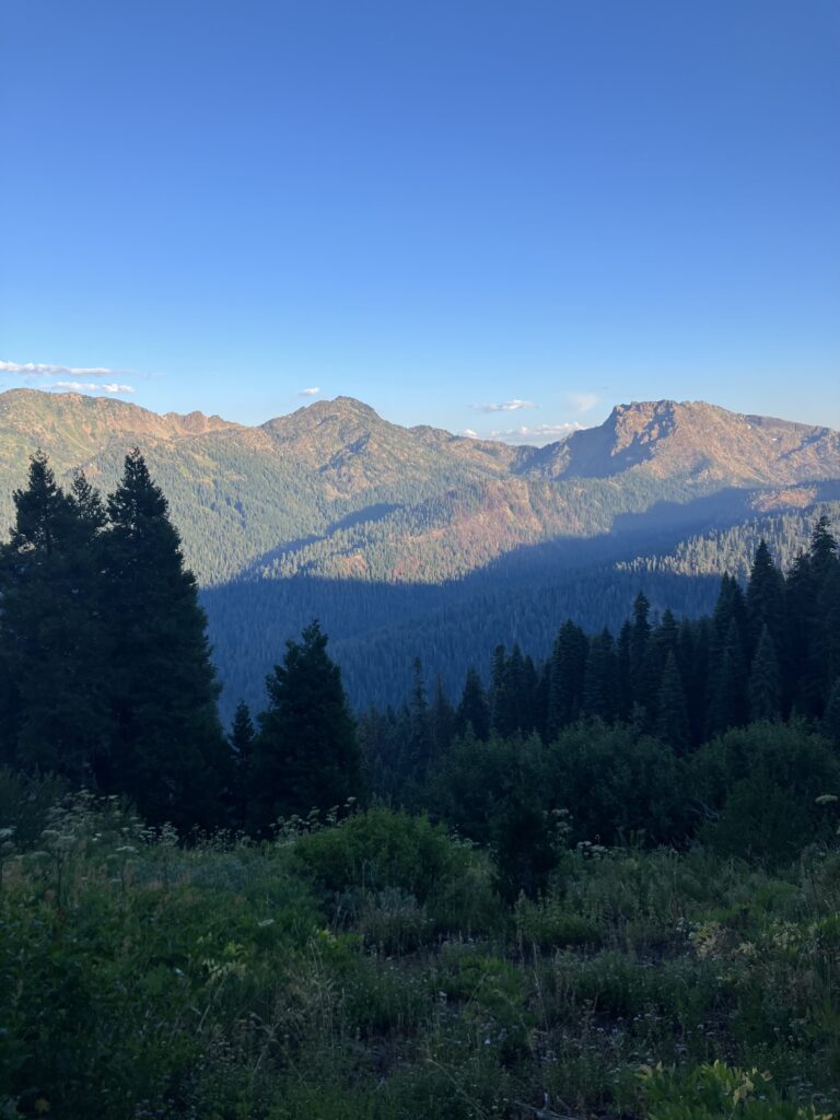
Because so many people skipped this entire section, it had been pretty quiet, but there were a number of other hikers at the store. All of them were planning on starting the climb out of town that evening. If there has been a defining feature of Northern California, it has been the way the trail is constantly descending several thousand feet to cross a river and then immediately climbing straight back up. The climb out of Seiad Valley was the last hurrah of California, the steepest one of the section. It was still very warm at 7pm, so I opted to stay the night at the campground and tackle the climb first thing in the morning. That turned out to be absolutely the right call, for me at least – it cooled down a lot overnight and was quite pleasant in the early morning. The climb was long and steep – I wasn’t setting any speed records – but it was also a very cool section of the trail, climbing up and over a steep, rocky ridge that reminded me of being in the Whites. A lot of hikers had opted to make the climb via a dirt road that met back up with the trail a few miles later, as it cut off a few miles and few hundred feet of elevation. However, this was definitely a case where doing the harder thing was worth it, and I felt bad that they’d missed all this.
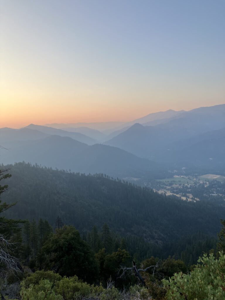
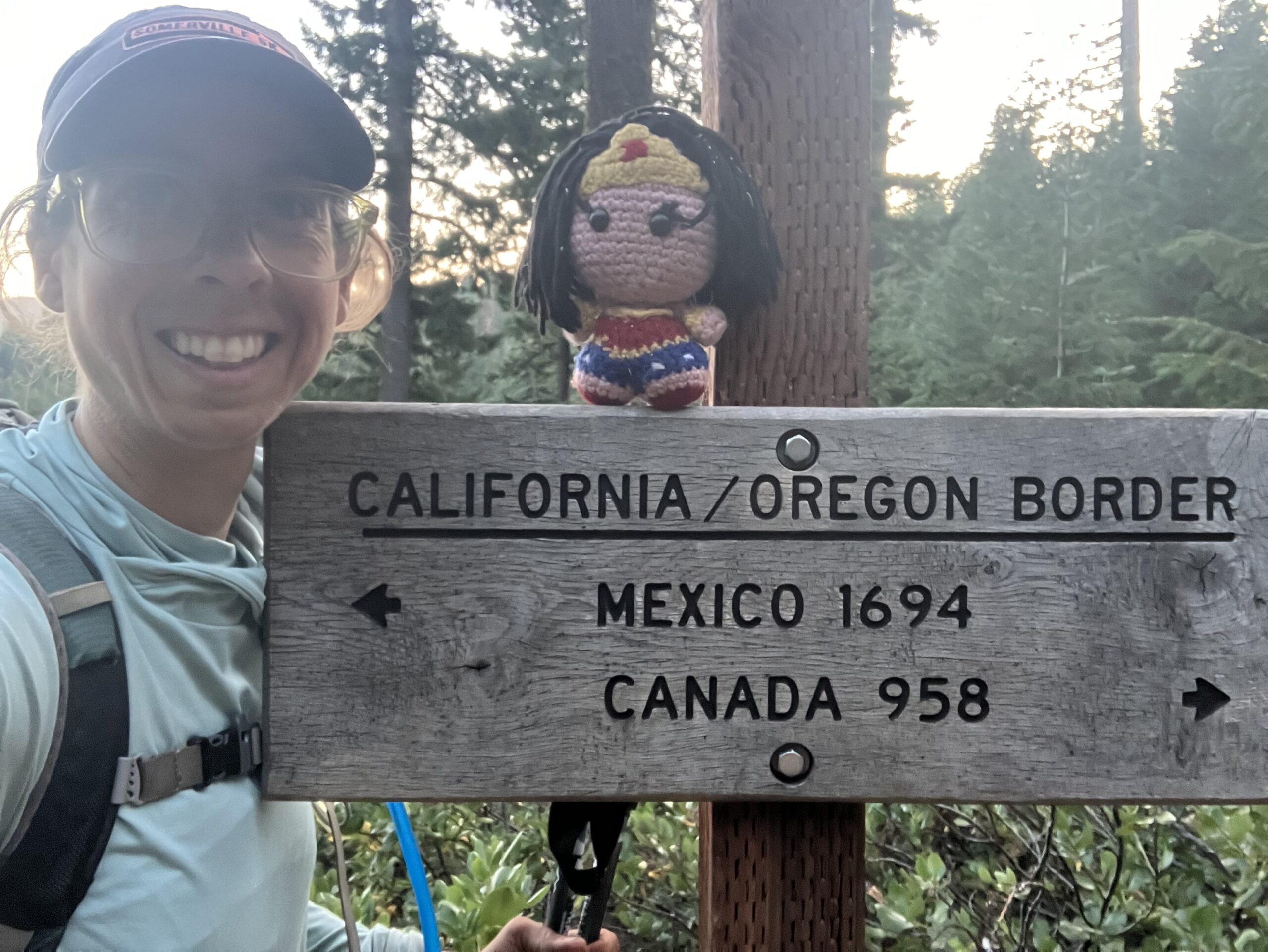
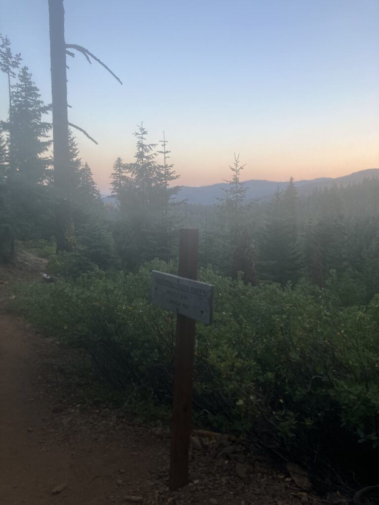
I hadn’t been planning on doing a super long day, given the elevation, but midway through the day, I was making good time and I got into a super manic mood. I decided that I really wanted to get to Oregon that day after all (or maybe I really wanted to leave California). It was a long day, and even after the main climb out of town, the trail wasn’t exactly flat. But it continued to be quite beautiful and it wasn’t too hot. It ended up being my longest day on trail yet, with the most elevation (74x my daily stair step goal, according to my watch), but I made it to the border just before sunset. After two months and three days, I had made it across California. Luckily, there was a large camping area just a quarter mile past the border, and there were about ten of us there, all having had the same goal for the day of finally making it to our second state.
The next day was a relatively easy hike into Ashland, a chance to take a shower and assess plans for the upcoming hike across Oregon. The fires aren’t quite as bad as it first seemed, but there is a fair amount of closed trail ahead. Ultimately, I’ll hike as much as I can, and take each closure as it comes. People have asked if I will go back to sections I have skipped, and the answer is, maybe. But life is short, and there are a lot other things I want to do in life with my limited time and resources. So, I think that I will largely have to be okay with the fact that however much of the trail I am able to do, that will be my PCT journey.